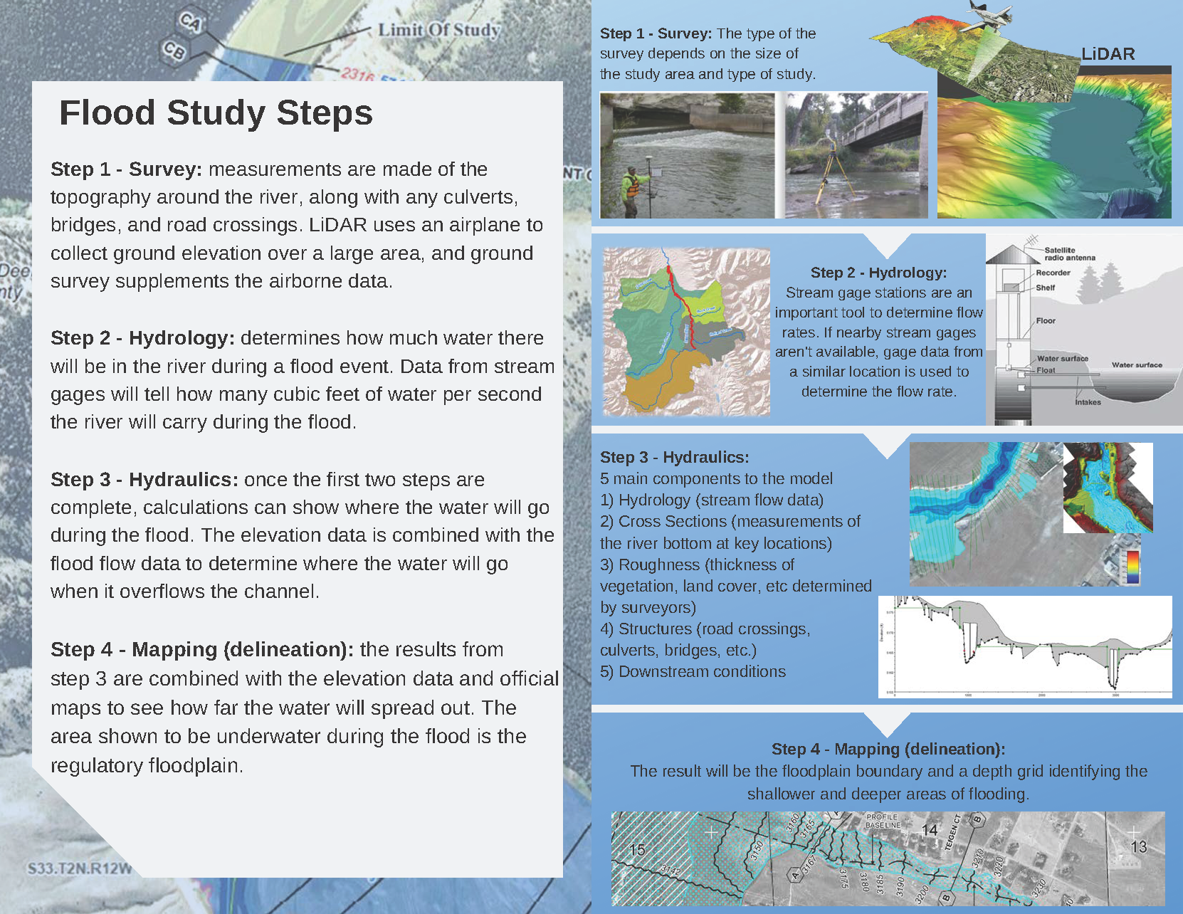
Developing regulatory floodplain maps is a complex process that uses the most accurate data available. The result of a flood study is a reliable map of the areas in a community that are at risk to flooding. Floodplain maps are critical tools for local officials to communicate and manage flood risk. To learn more about what goes into a flood study you can click here or visit FEMA's website. Below are all the current flood studies currently underway across the state. To access the project page click on the project button.
