“The people of the state of Montana find that recurrent flooding of a portion of the state's land resources causes loss of life, damage to property, disruption of commerce and governmental services, and unsanitary conditions; all of which are detrimental to the health, safety, welfare, and property of the occupants of flooded lands and the people of this state; and the public interest necessitates management and regulation of flood-prone lands and waters in a manner consistent with sound land and water use management practices which will prevent and alleviate flooding threats to life and health and reduce private and public economic losses.” MCA title 76 chapter 5 Floodplain and Floodway Management Act
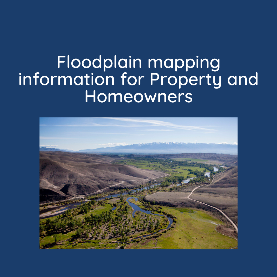
Flooding is the most common disaster in the United States. Severe flooding can cause immense damage. In many cases, entire livelihoods can be wiped out by a flood. It’s important to understand your flood risk; by understanding your flood risk you are better able to protect your family and property from harm.
To learn more about your current flood risk please visit FEMAs Map Service Center (MSC). Instructions on how to navigate the MSC and the national flood hazard layer can be found here.
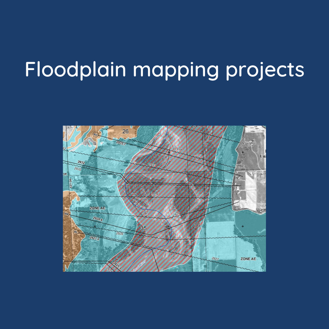
The Montana floodplain mapping program works with FEMA and communities across the state to identify flood risks. Identifying flood risk can help keep your home and local community safe from future flood events. Floodplain maps are one tool in learning and understanding flood risk.
| Flood risk changes over time, floodplain maps will require periodic updates. Several factors can change flood risk things such as, the age of the flood study, if there has been a lot of change or development in the area, or due to a flooding event. Flood studies now are done in collaboration with communities, DNRC, and FEMA. The state floodplain program has developed a comprehensive plan to outline future mapping projects. This plan is updated annually to align with community requests and to update outdated flood study information. |  |
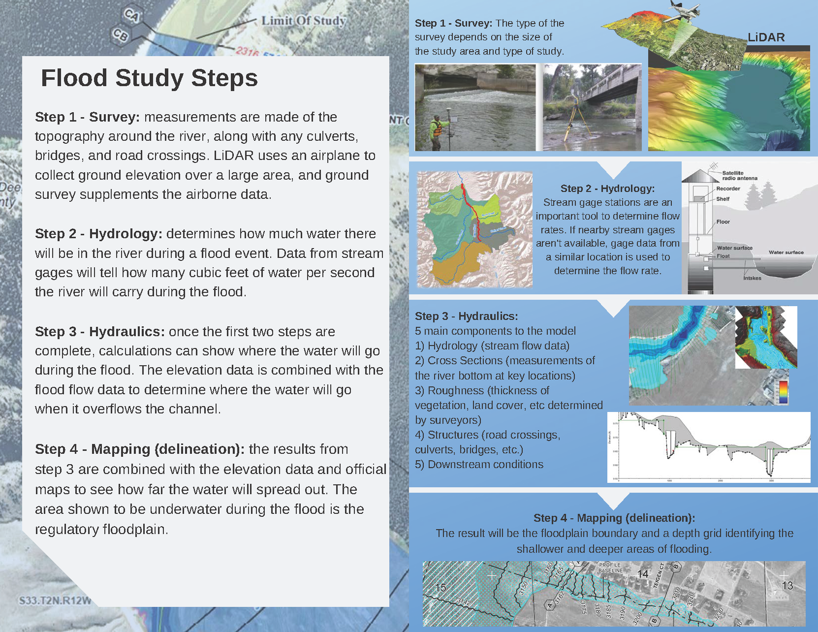
Flood studies today use the best available data and technology. This includes high-accuracy topographic information, updated hydrologic data, and modern engineering methods.
To understand what goes into a flood study click here to learn more.
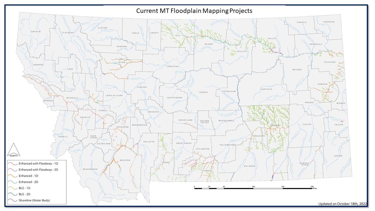
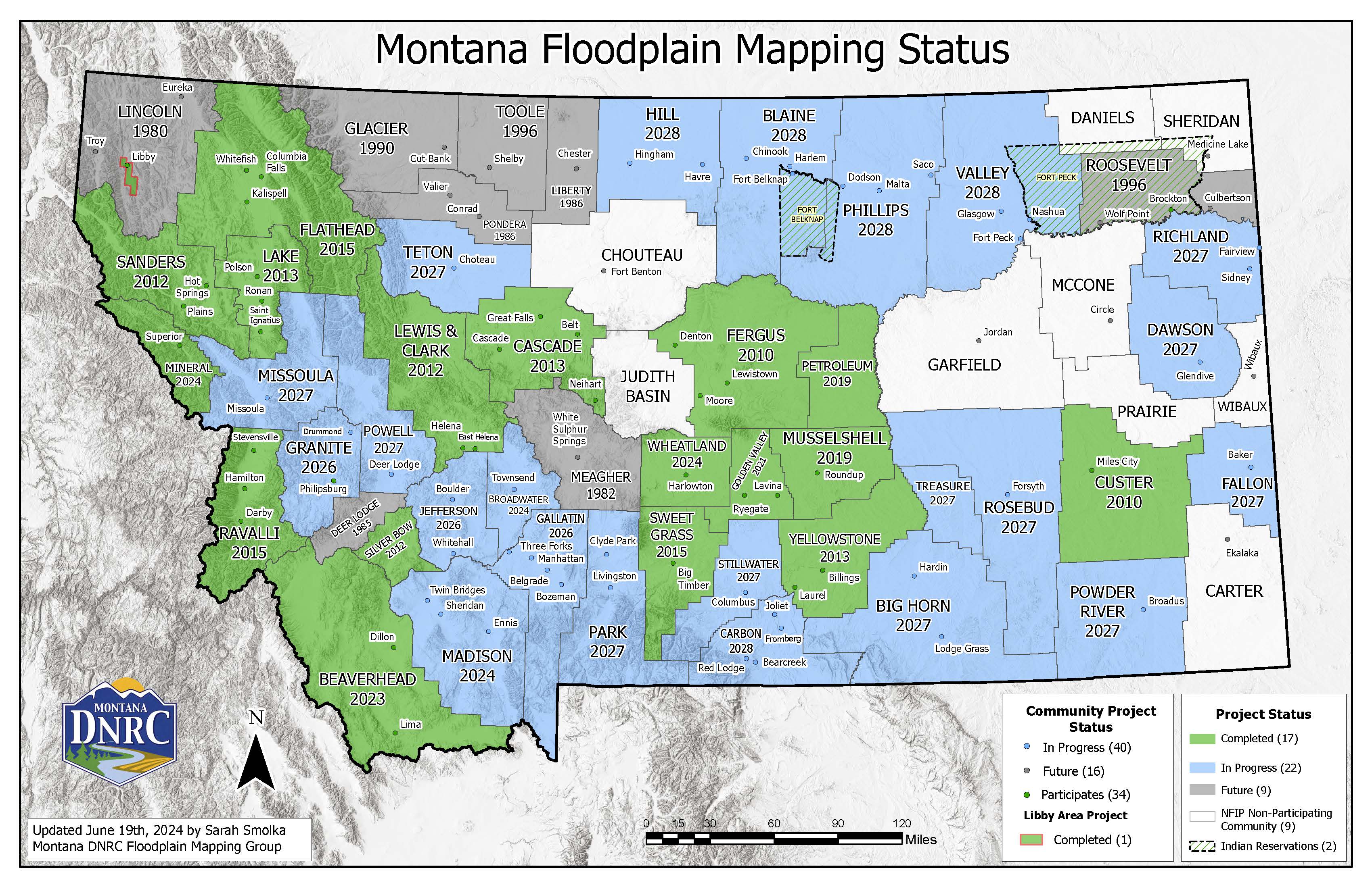
Mapping Projects and Resources