Gallatin County and the City of Three Forks have been working with the Federal Emergency Management Agency (FEMA) and Montana Department of Natural Resources and Conservation (DNRC) to produce new and updated 1% annual chance (100-year) floodplain maps. The project includes updating all the existing mapped floodplains for the Madison and Jefferson Rivers.
Updated floodplain maps will depict the latest, most accurate flood risk data, and will eventually result in updated FEMA floodplain maps. The existing FEMA floodplain maps on the Madison and Jefferson Rivers are based on data collected in the late 1970s early 1980s. For more information see: Floodplain FAQs Flood Study Process
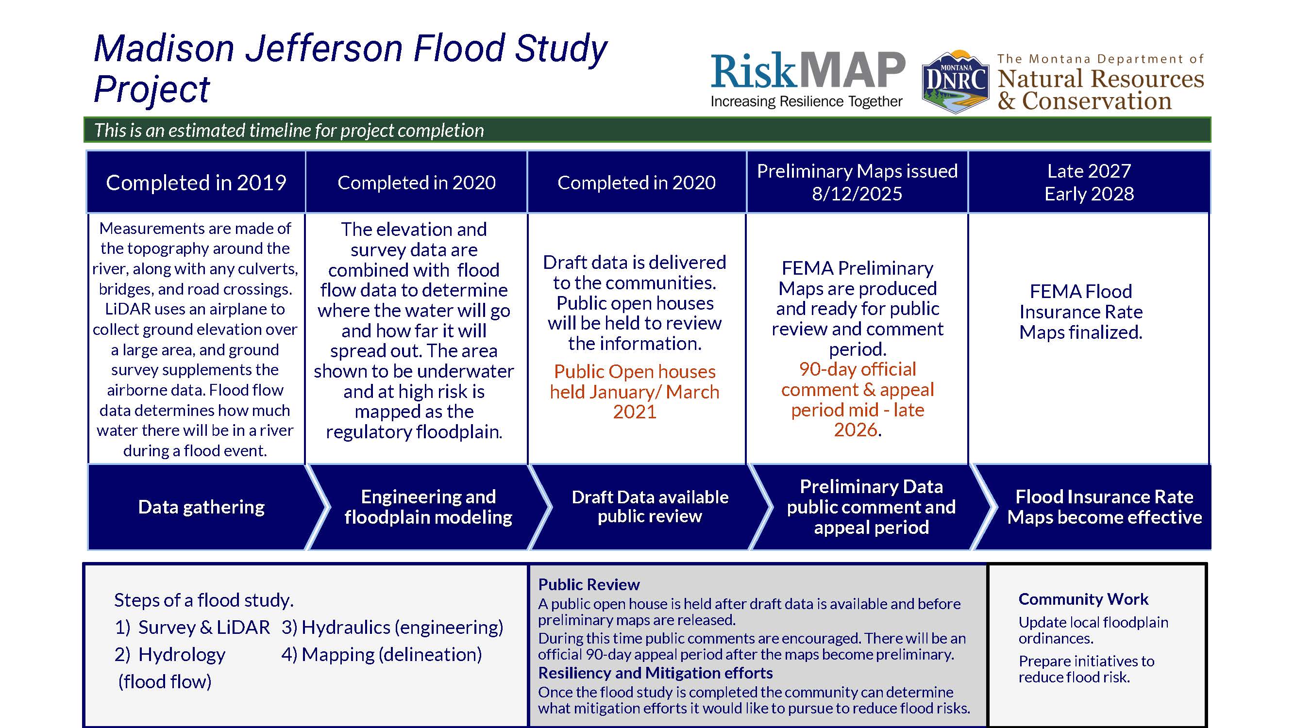
Project Timeline
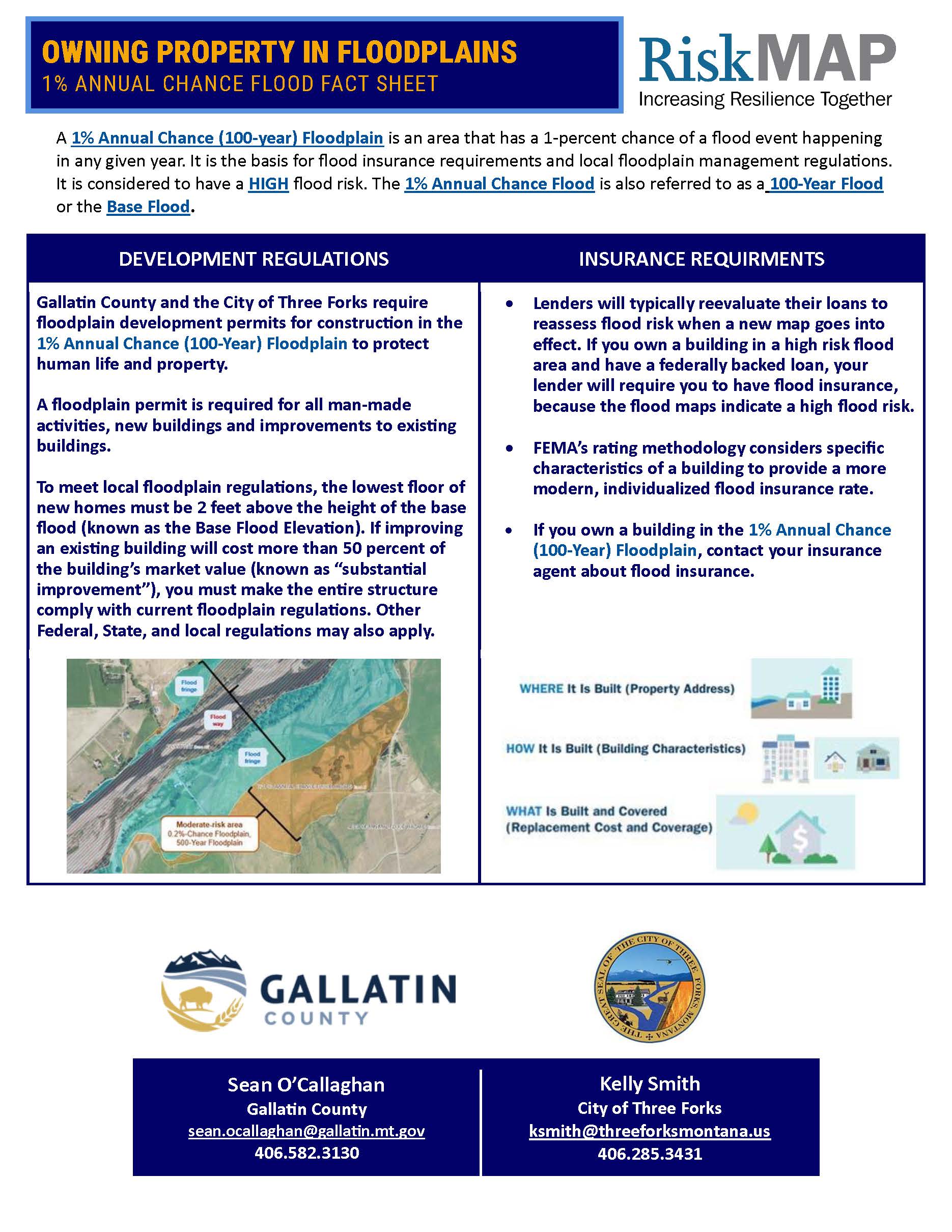
Flood Insurance Rate Maps indicate areas of flood risk. Once this project is complete, new and updated Flood Insurance Rate Maps will provide more accurate, current, and detailed data and mapping of flood risk areas. New floodplain studies involve collecting and analyzing data, including: topography, hydrology analyses, and hydraulic analysis.
Project Updates
Preliminary Flood Insurance Rate Maps and the Preliminary Flood Insurance Study have been issued as of August 12, 2025. Preliminary maps can be viewer here on FEMA's Map Service Center, on the State Flood Hazard Viewer (link below), or hard copies will be available at County and City offices. Instructions to access FEMAs map service center and the National Flood Hazard Layer are shown below.


Link to FEMAs Map Service Center FEMA Flood Map Service Center | Welcome!
Link to FEMAs National Flood Hazard Layer FEMA's National Flood Hazard Layer (NFHL) Viewer
Meeting Information
February 11, 2020 Three Forks Project Update Meeting | view slides
May 5, 2020 Three Forks Webinar | view slides
September 19, 2020 Three Forks Project Update Meeting | view slides
November 10, 2020 Flood Risk Review Three Forks | view slides
December 2, 2020 Open House Three Forks | view slides
January 6, 2021 Open House Three Forks | view slides
January 20, 2021 Flood Risk Review Gallatin County | view slides
March 9, 2021 Open House Madison River | view slides
March 10, 2021 Open House Jefferson River | view slides
October 1, 2025 Preliminary Map Meeting Gallatin County | view slides
October 1, 2025 Preliminary Map Meeting Three Forks | view slides
View Preliminary Flood Insurance Rate Maps
The preliminary flood study information and maps need to go through a lengthy technical and public review process before being finalized. When finalized, new maps could have effects on some property owners in mapped floodplains.
Know Your Property's Flood Risk


Reports are available from the local Floodplain Administrator upon request.
Contact Information
For more information on the project please contact the local floodplain administrators.
Gallatin County
Sean O'Callaghan
sean.ocallaghan@gallatin.mt.gov
406.582.3130
City of Three Forks
Kelly Smith
ksmith@threeforksmontana.us
406.285.3431