
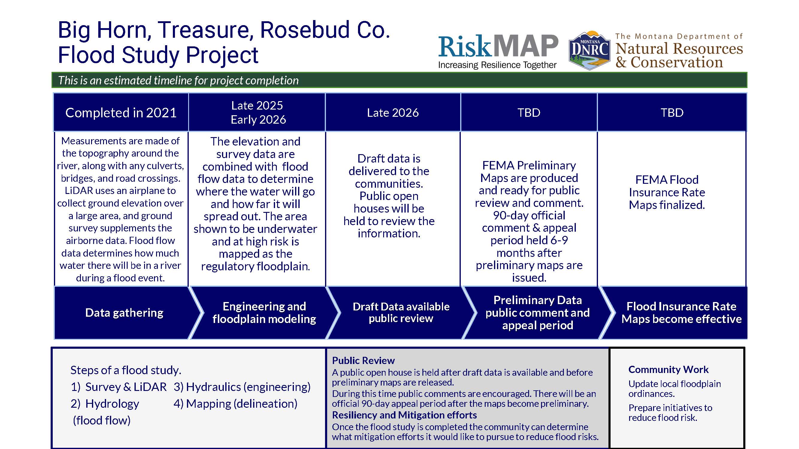
Big Horn, Treasure, and Rosebud Counties have been working with the Federal Emergency Management Agency (FEMA) and Montana Department of Natural Resources and Conservation (DNRC) to produce new and updated 1% annual chance (100-year) floodplain maps. The project includes updating all the existing mapped floodplains, and producing new maps for portions of Rosebud County.
Updated floodplain maps will depict the latest, most accurate flood risk data, and will eventually result in updated FEMA floodplain maps. Most of the existing FEMA floodplain maps are based on data from the 1970s and 1980s. For more information see: Floodplain FAQs Flood Study Process.
Project Timeline
Flood Insurance Rate Maps indicate areas of flood risk. Once this project is complete, new and updated Flood Insurance Rate Maps will provide more accurate, current, and detailed data and mapping of flood risk areas. New floodplain studies involve collecting and analyzing data including: topography, hydrology analyses and hydraulic analysis.
Project Updates
Data development is currently underway for all the counties check back for project updates and the availability of draft data when data development is complete.
Project Kickoff meetings
September 14, 2021 | Big Horn/ City of Hardin/ Town of Lodge Grass | view slides
September 15, 2021 | Treasure County | view slides
September 15, 2021 | Yellowstone County | view slides
September 16, 2021 | Rosebud County | view slides
State Flood Hazard Viewer
Draft data is not yet complete for the project areas. Once the data is complete it will be loaded onto the State Flood Hazard Viewer to share with the public.
 FEMAs Flood Insurance Rate Explanation Guide
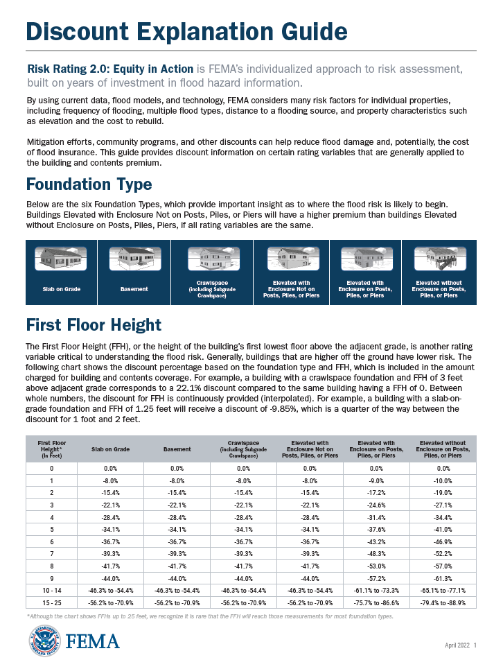 FEMAs Discount Explanation Guide
Contact Information
For more information on the project please contact the local floodplain administrators.
Big Horn County
Sylvan Covers Up
scoversup@bighorncountymt.gov
(406) 665-9735
City of Hardin
Nathan McConnell
nmcconnell@hardinmt.com
(406) 665-9260 ext 106
Town of Lodge Grass
Joe Lovato
(406) 672-0510
Treasure County
Lindsey Kimball
lkimball@treasurecountymt.com
(406) 342-5547
Rosebud County
Robert Lee
rlee@rosebudcountymt.com
(406)346-2969
City of Forsyth
Richard Thompson
rthompson@rangeweb.net
(406) 346-2728