Park, Stillwater, and Carbon Counties have been working with the Federal Emergency Management Agency (FEMA) and Montana Department of Natural Resources and Conservation (DNRC) to produce new and updated 1% annual chance (100-year) floodplain maps. The project includes updating all the existing mapped floodplains after the historic 2022 flood event.
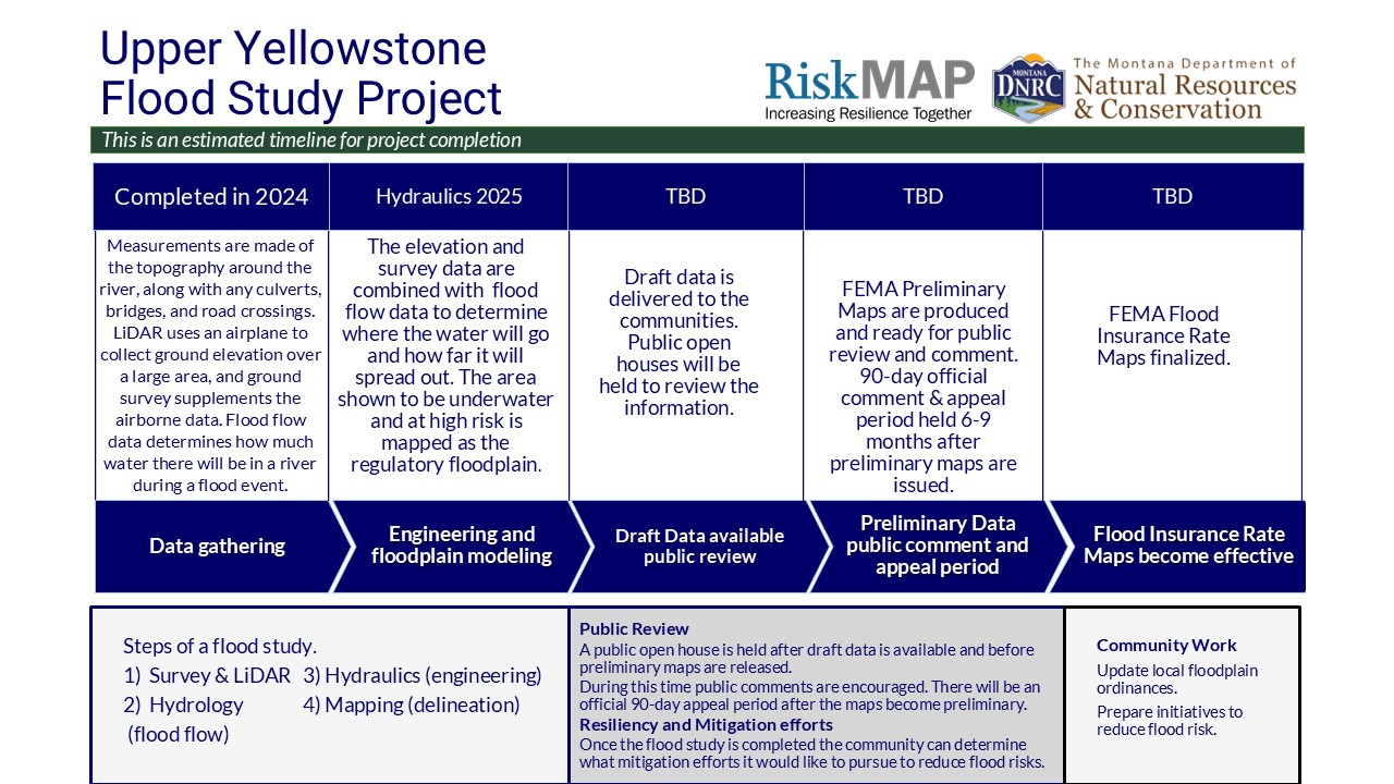
Updated floodplain maps will depict the latest, most accurate flood risk data, and will eventually result in updated FEMA floodplain maps. Most of the existing maps for these streams are based on older data. These maps need to be updated periodically. For more information see: Floodplain FAQs Flood Study ProcessProject Timeline
Flood Insurance Rate Maps indicate areas of flood risk. Once this project is complete, new and updated Flood Insurance Rate Maps will provide more accurate, current, and detailed data and mapping of flood risk areas. New floodplain studies involve collecting and analyzing data, including: topography, hydrology and hydraulic analysis.
Project Updates
Data development is currenlty underway, check back for project updates and availability of draft data when data development is complete.
Meeting Information
Meeting materials are available upon request.
Kick off meetings
September 19, 2022 Carbon County
September 19, 2022 Park County
September 19, 2022 Stillwater County
State Flood Hazard Viewer
Draft data is not yet complete for the project area. Once the data is complete it will be loaded onto the State Flood Hazard Viewer to share with the public.
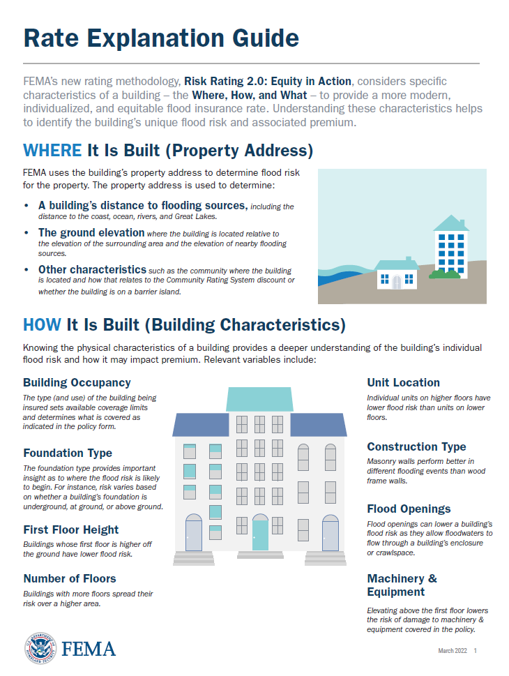 FEMAs Flood Insurance Rate Explanation Guide
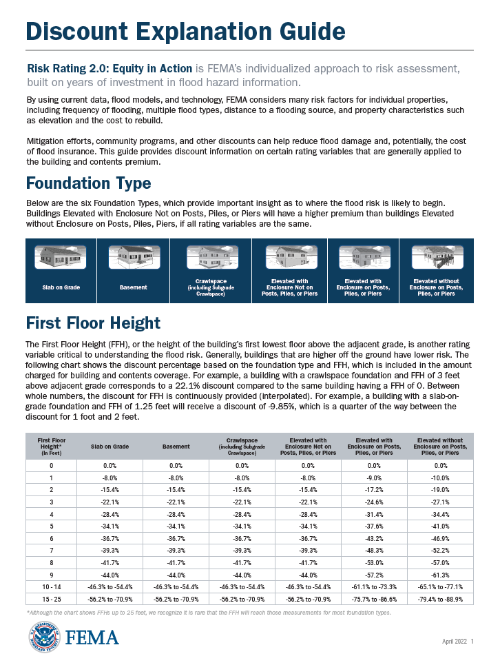 FEMAs Discount Explanation Guide
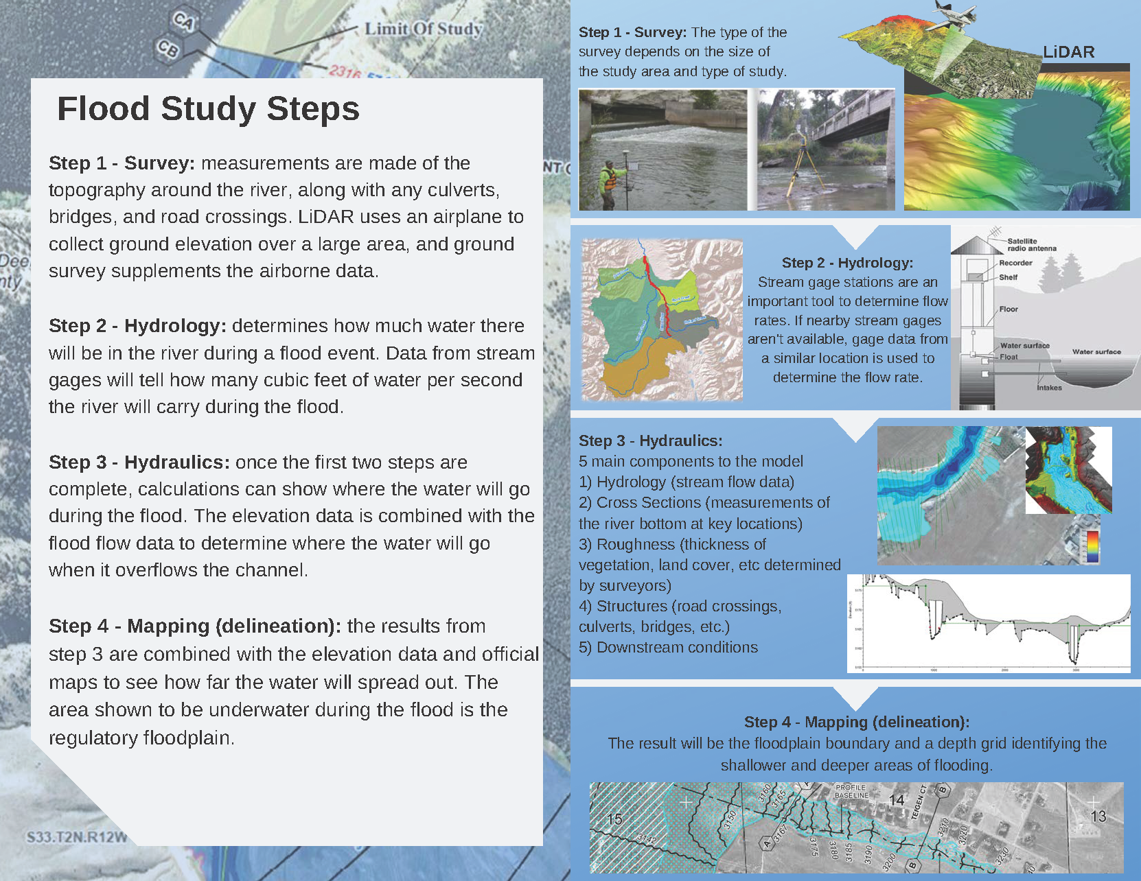
Contact Information
For more information on the project please contact the local floodplain administrator.
Park County
Lawson Moorman
lmoorman@parkcounty.org
(406) 222-4102
City of Livingston
Jennifer Severson
jseverson@livingstonmontana.org
(406) 222-4903
Clyde Park
Lawson Moorman
lmoorman@parkcounty.org
(406) 222-4102
Stillwater County
Cindy Grover
cindyg@stillwatercountymt.gov
(406) 322-8055
City of Columbus
Peyton Brookshire
director@townofcolumbus.com
(406) 322-4424
Carbon County
Aimee Bailey
carboncd@macdnet.org
(406) 962-3641 105
City of Red Lodge
Dave Westwood
mayor@cityofredlodge.com
(406) 446-1606
Town of Joliet
Amber Foechterle
townofjoliet@gmail.com
(406) 962-3567
Town of Fromberg
Terry Feller / Michele Auch
clerk@fromberg-mt.com
(406) 668-7383
Town of Bearcreek
Jane Swanson-Webb
jane@townofbearcreekmt.com
(406) 425-1108