Teton County and the City of Choteau have been working with the Federal Emergency Management Agency (FEMA) and Montana Department of Natural Resources and Conservation (DNRC) to produce new and updated floodplain maps for the Teton River, Sun River, Spring Creek, Deep Creek, Muddy Creek and Tributaries. The project includes updating all the existing mapped floodplains in the county and adding a few more miles to existing mapped floodplains.
Updated floodplain maps will depict the latest, most accurate flood risk data, and will eventually result in updated FEMA floodplain maps. Many of the existing floodplain maps are based on data from the late 1970s. For more information see: Floodplain FAQs Flood Study Process
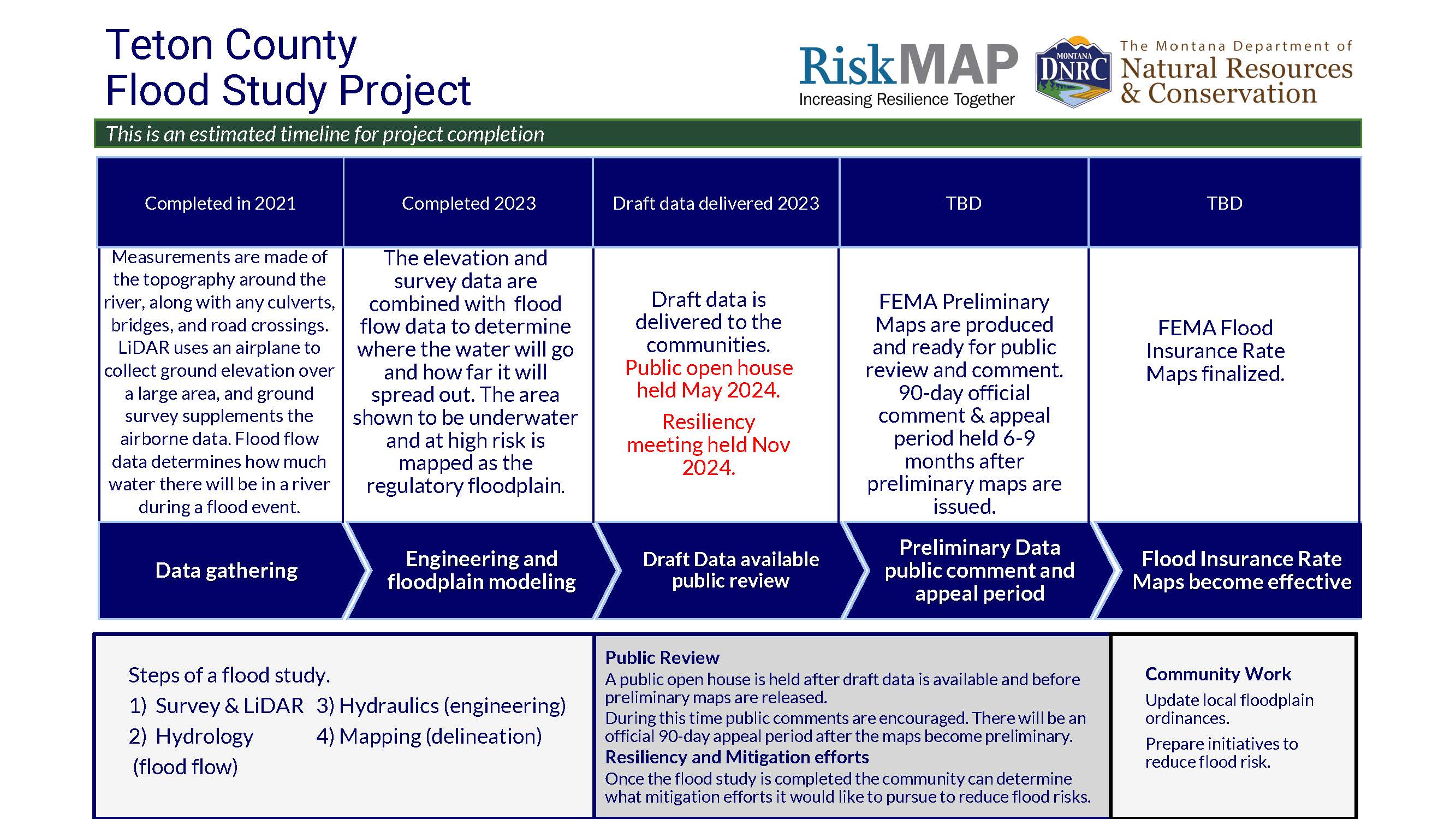
Project Timeline
Flood Insurance Rate Maps indicate areas of flood risk. ONce this project is complete, new and updated Flood Insurance Rate Maps will provide more accurate, current, and detailed data and mapping of flood risk areas. New floodplain studies involve collecting and analyzing data, including: topography, hydrology analyses, and hydraulic analysis.
Project Updates
Draft Data is now available for review and consideration. The past several years was spent collecting data to compile and model to identify the flood risk for the communities. FEMA is currently reviewing the flood study results and working on putting this information on Preliminary Flood Insurance Rate Maps (FIRMs).
Meeting Information
September 3, 2020 Project kick off meeting Teton County and City of Choteau | view slides
October 25, 2023 Flood Risk Review meeting Teton County and City of Choteau | view slides | view video recording
February 21, 2024 Project Update meeting Teton County and City of Choteau | view slides | view video recording
April 30, 2024 Hydrology Review meeting Teton County and City of Choteau | view slides | view video recording
May 29, 2024 Public Open House meeting | view slides
November 14, 2024 Flood Resiliency Meeting Teton County | view slides | view video recording
November 14, 2024 Flood Resiliency Meeting City of Choteau | view slides | view video recording
View Draft Flood Study Mapping
The draft flood study data and maps need to go through a lengthy technical and public review process before being finalized. When finalized, new maps could have effects on some property owners in mapped floodplains.
Know Your Property's Flood Risk
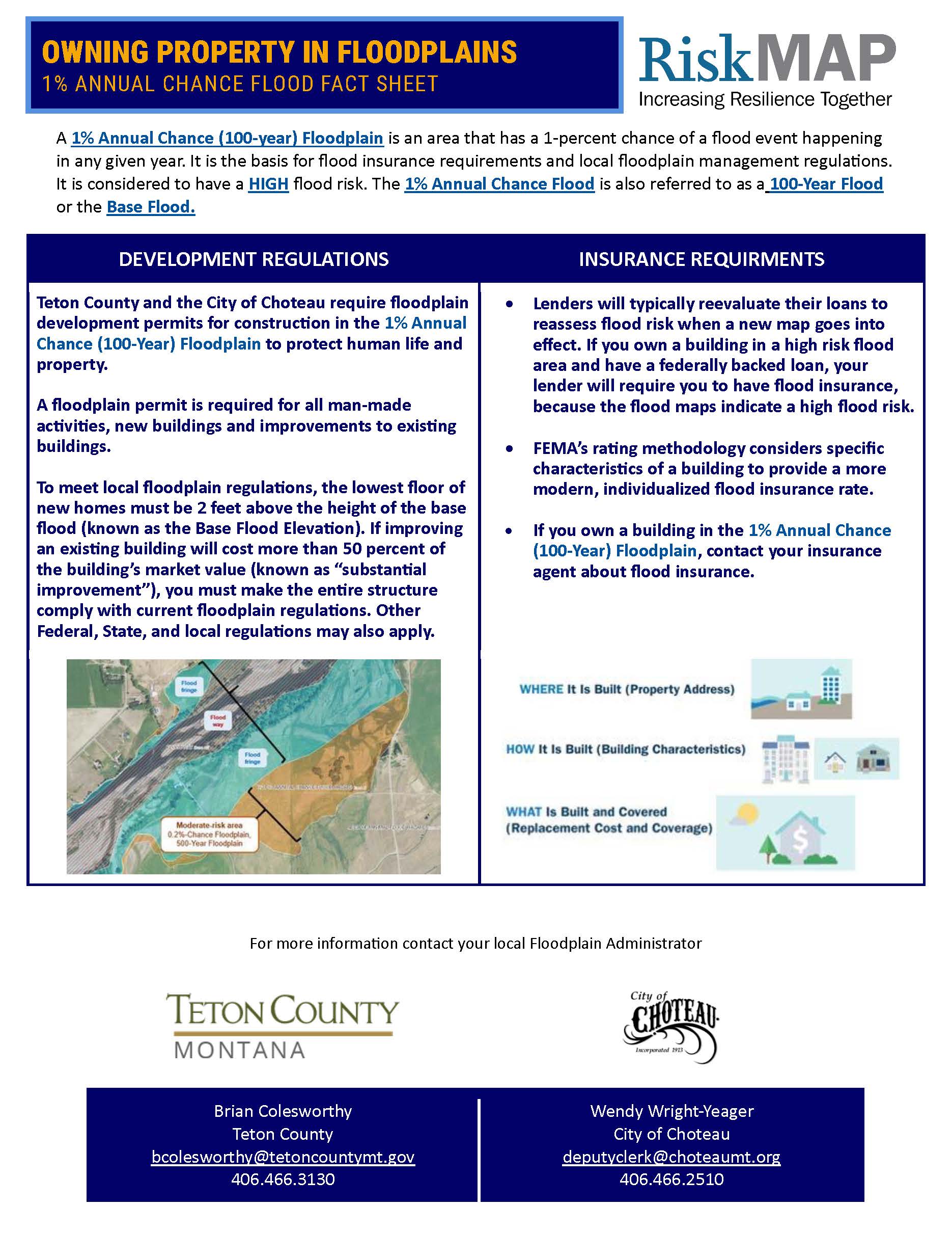
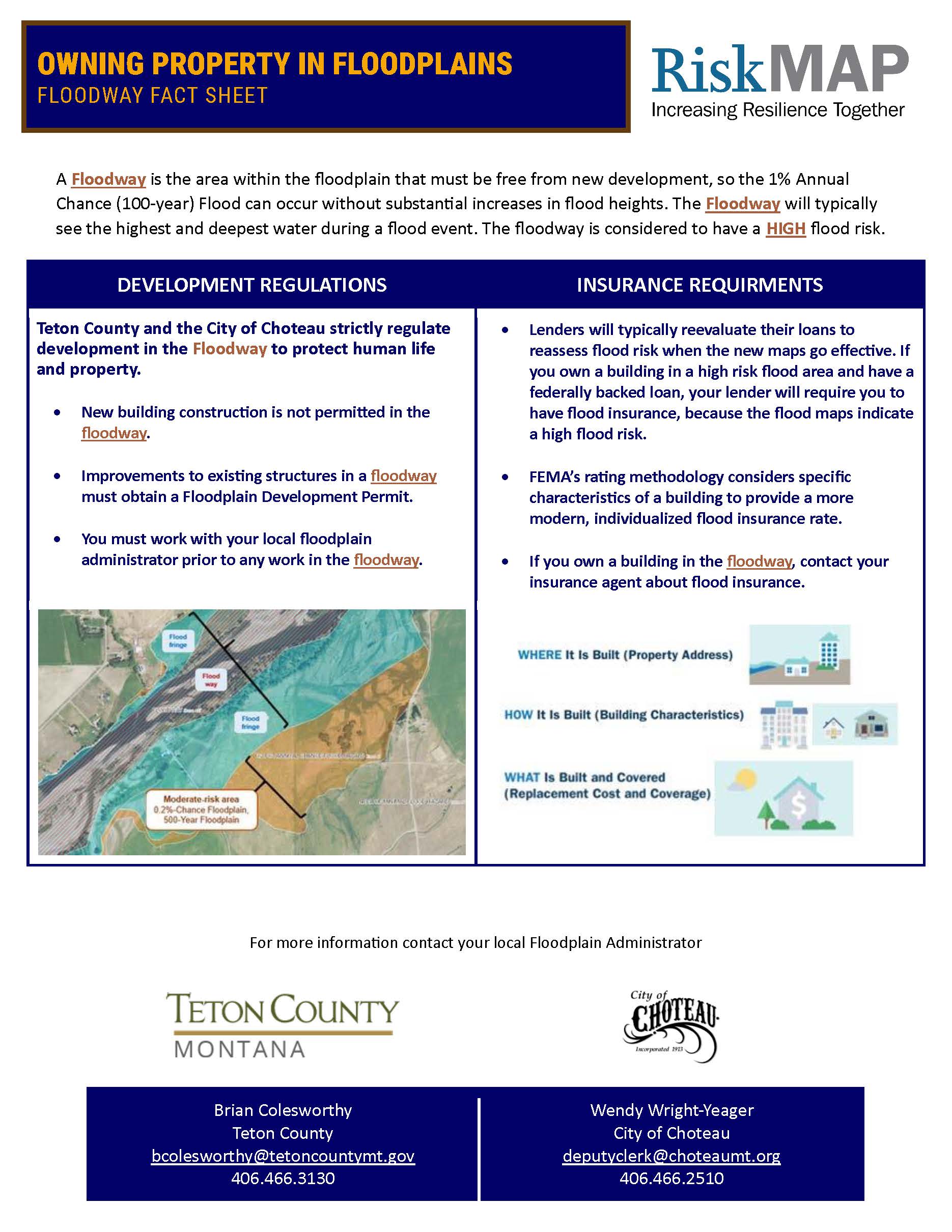
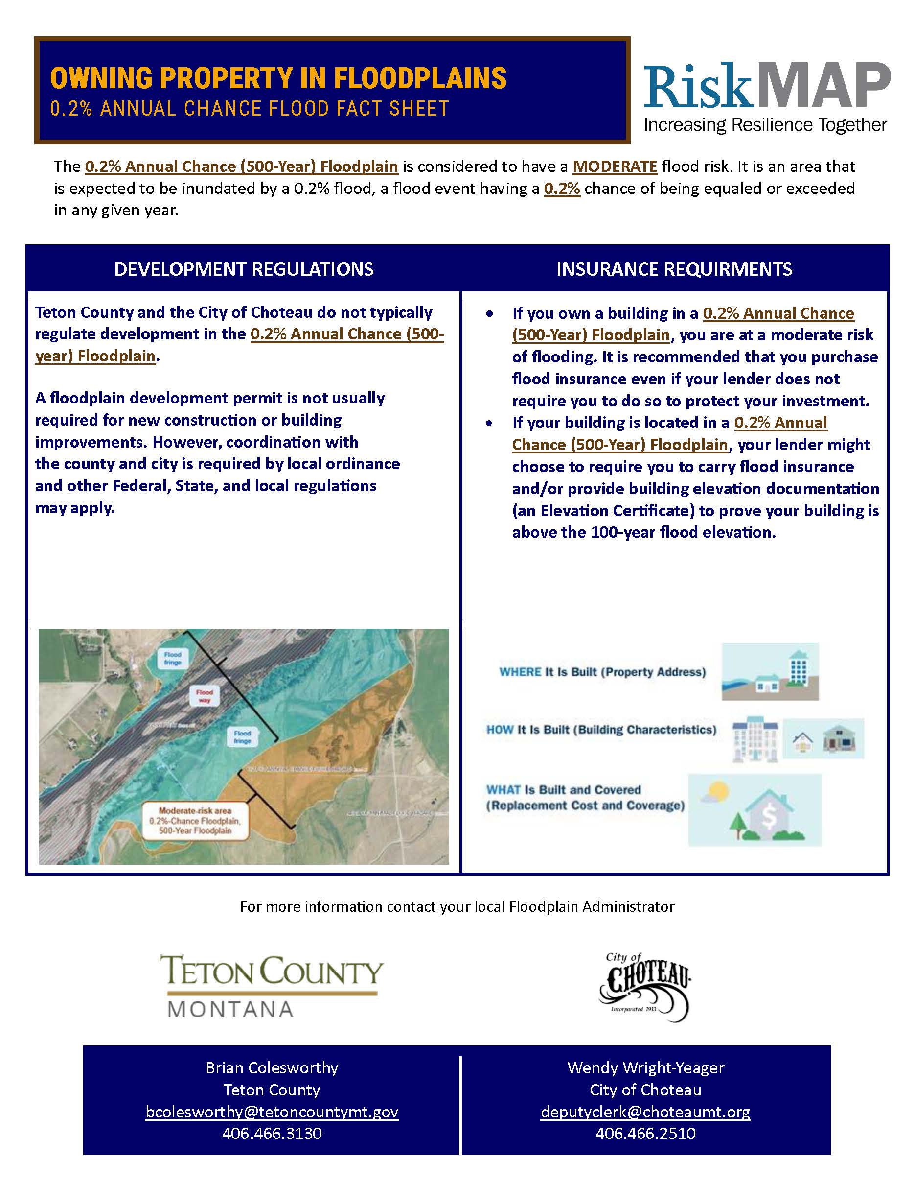
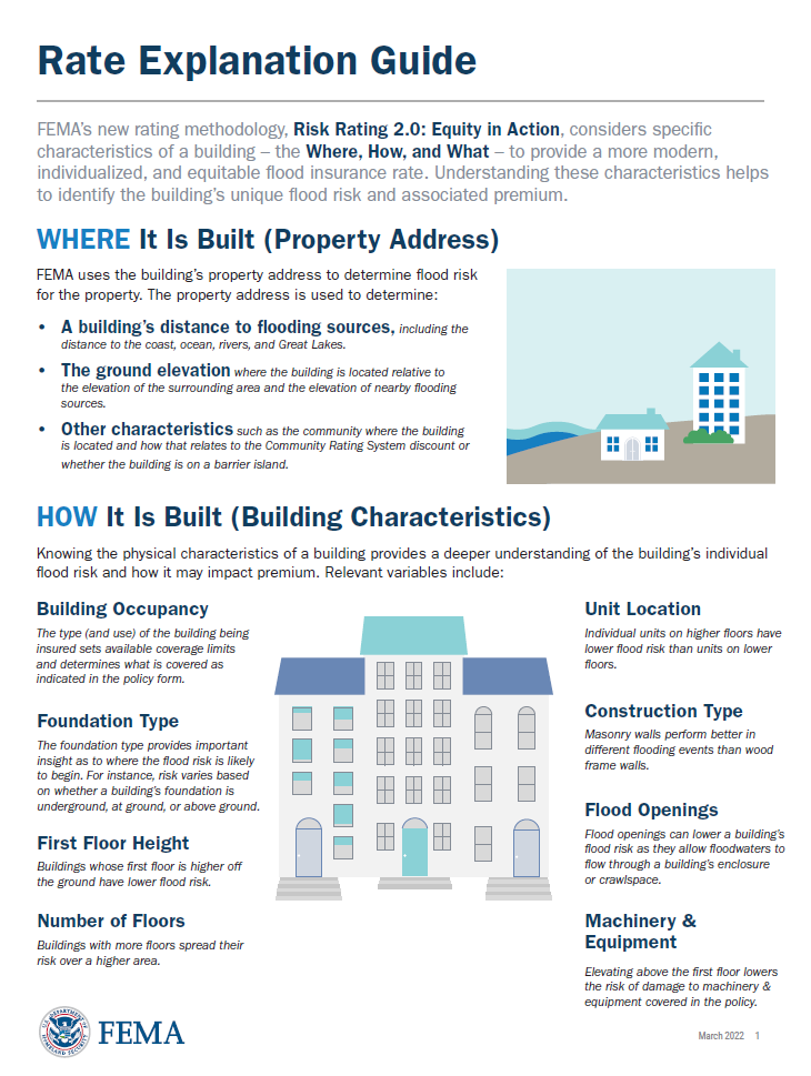 FEMA Flood Insurance Rate Explanation Guide
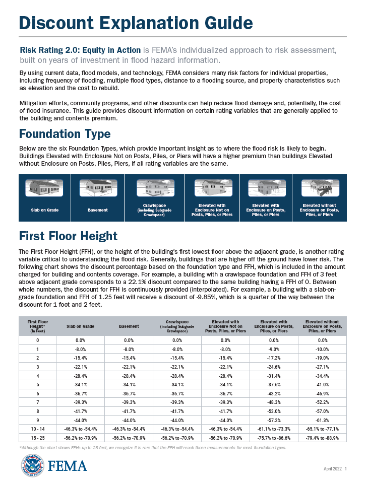 FEMA Flood Insurance Discount Explanation Guide
Flood study reports are available from the local Floodplain Administrator upon request.
Contact Information
For additional questions contact your local floodplain administrator.
Teton County
Brian Colesworthy
Teton County Floodplain Administrator
bcolesworthy@tetoncountymt.gov
406.466.3130
City of Choteau
Wendy Wright-Yeager
City of Choteau
deputyclerk@choteaumt.org
406.466.2510