Powell County and the City of Deer Lodge have been working with the Federal Emergency Management Agency (FEMA) and Montana Department of Natural Resources and Conservation (DNRC) to produce new and updated 1% annual chance (100-year) floodplain maps. The project includes updating all the existing mapped floodplains for the for the Clark Fork, Blackfoot, and Little Blackfoot Rivers, Cottonwood Creek, and Tributaries.
Updated floodplain maps will depict the latest, most accurate flood risk data, and will eventually result in updated FEMA floodplain maps. Many of the existing floodplain maps are based on data from the late 1970s. For More information see Floodplain FAQs and the Flood Study Process.
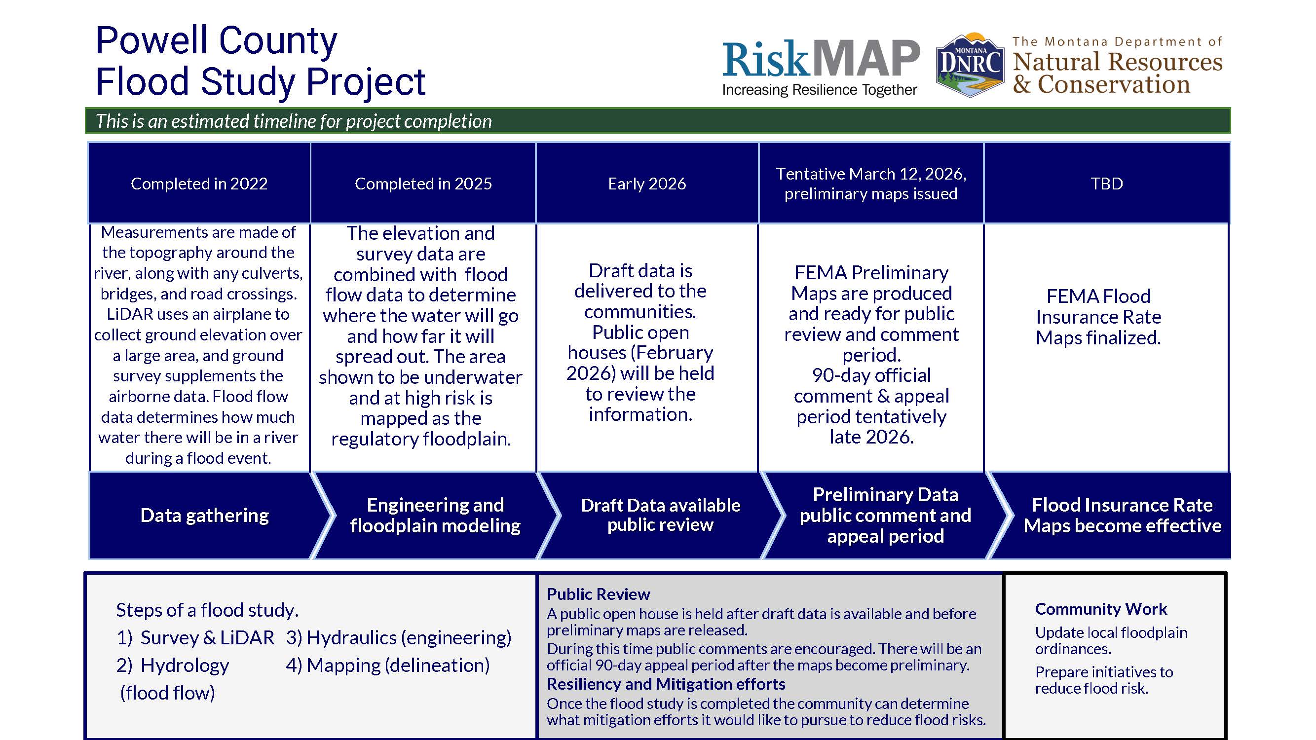
Project Timeline
Flood Insurance Rate Maps (FIRMs) indicate areas of flood risk. Once this project is complete, new and updates FIRMs will provide more accurate, current, and detailed data and mapping of the flood risk areas. New floodplain studies involve collecting and analyzing data, including: topography, hydrology analyses, and hydraulic analysis.
Project Updates
Public Open House Meetings
Little Blackfoot River and Tribs focus
February 11, 2026; 5:00-7:00 pm
Avon Clubhouse
(DNRC and County facilitated)
Clark Fork River and Tribs focus
February 12, 2026; 5:00-7:00 pm
Powell County Community Center
(DNRC, County, City facilitated)
Blackfoot River and Tribs focus
March 4, 2026: 5:00-7:00 pm
Helmville Community Center
(County facilitated)
View Draft Floodplain Maps
The flood study is complete and is ready for review. Data goes through a lengthy technical review process before draft data is put on Preliminary Flood Insurance Rate Maps.
Know Your Property's Flood Risk
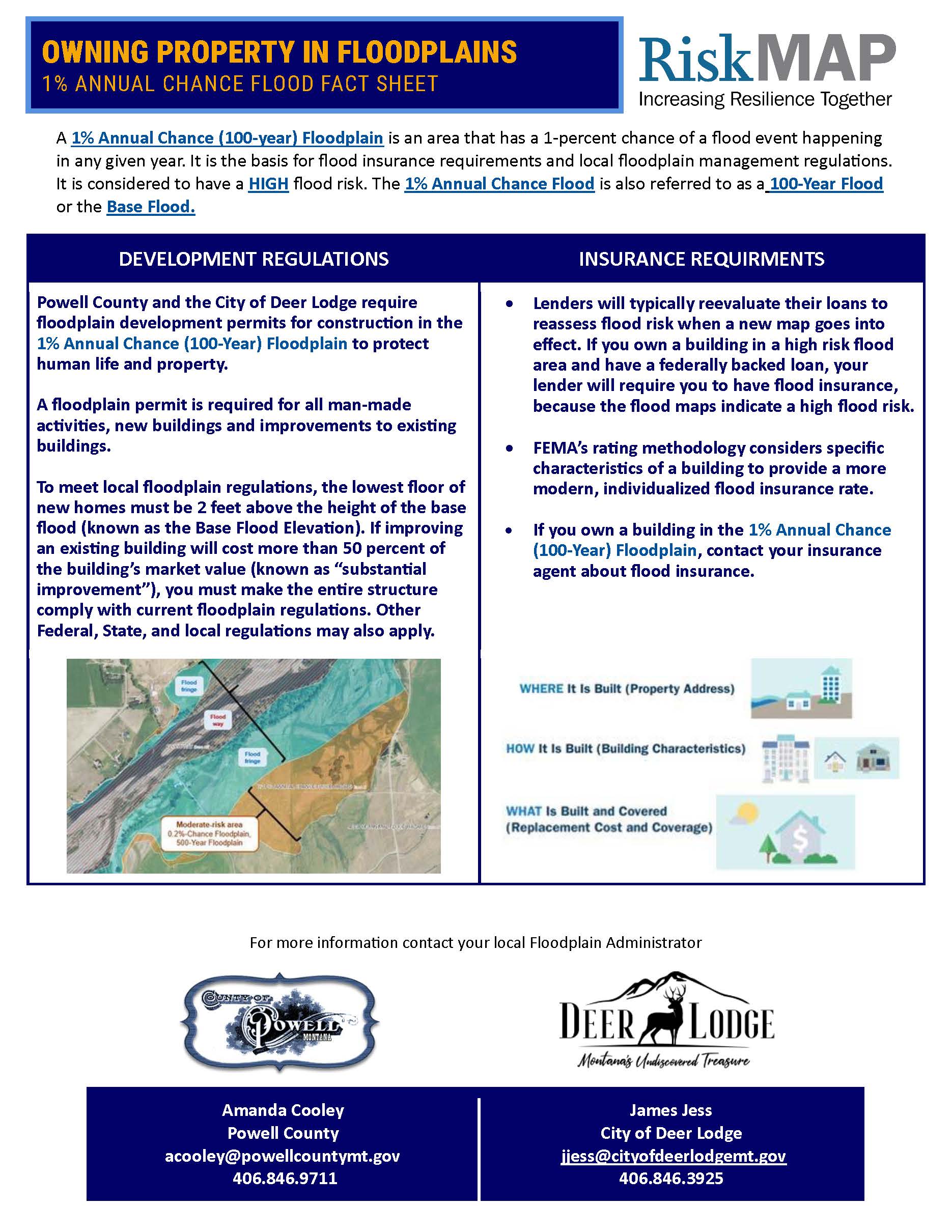
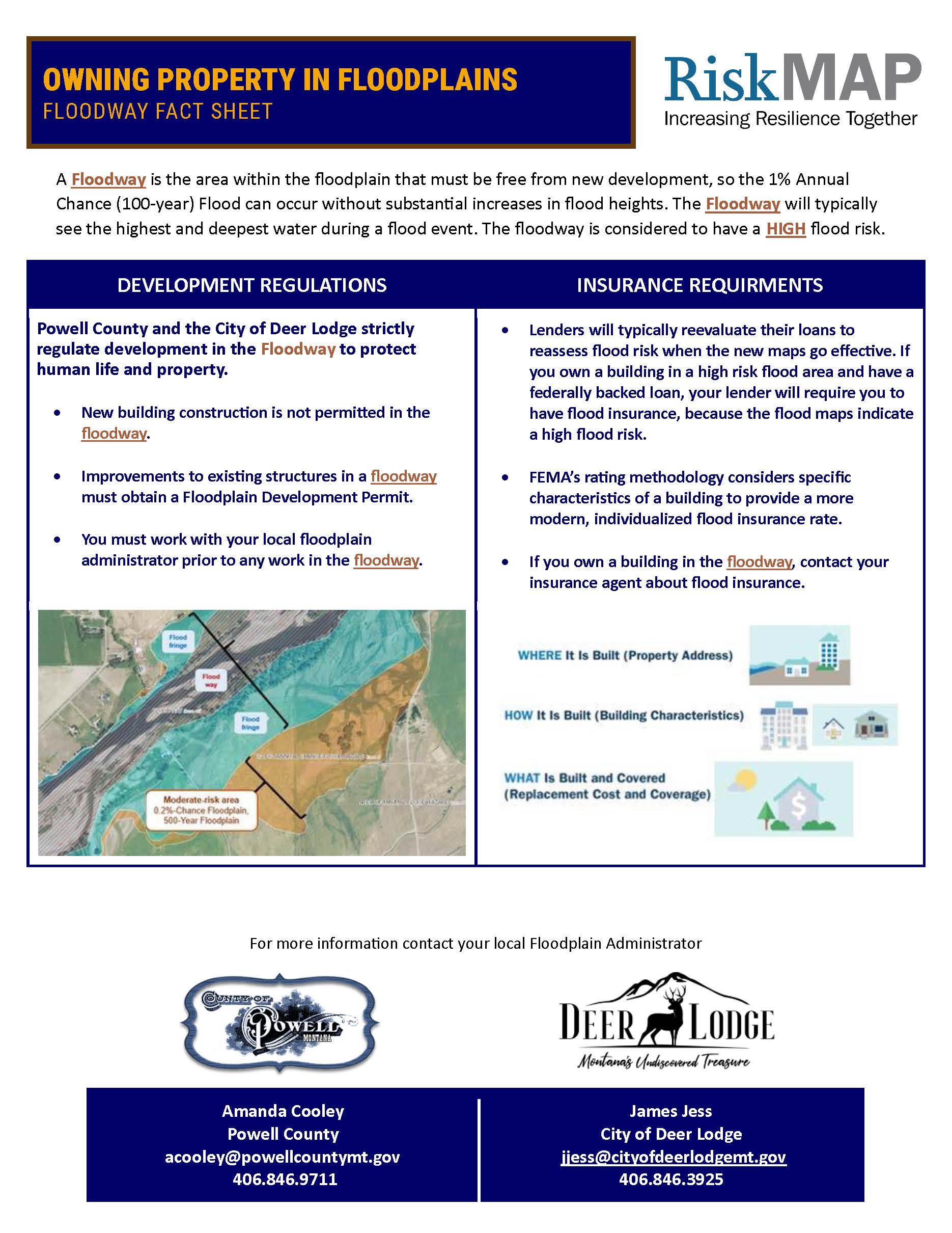
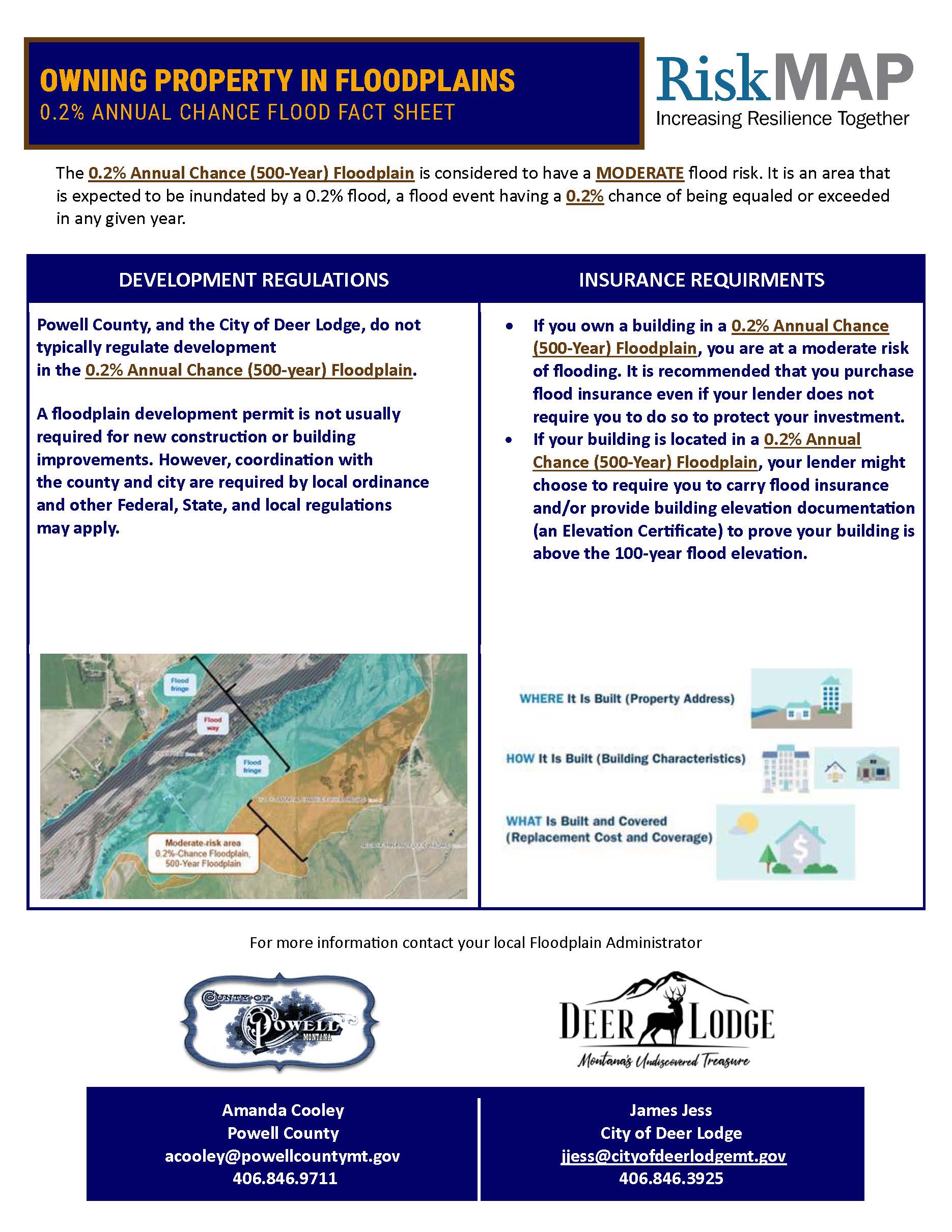 0.2% Floodplain factsheet
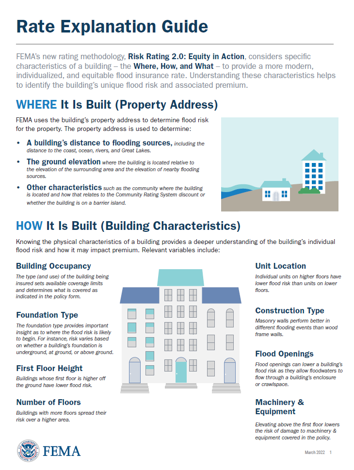 FEMA Flood Insurance Rate Explanation Guide
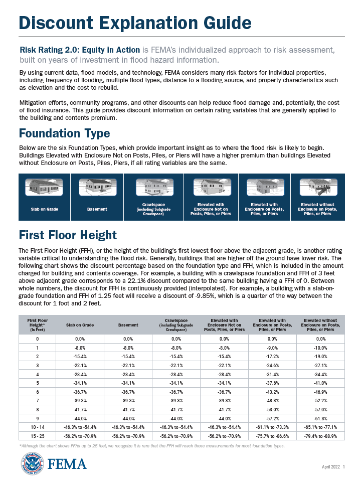 FEMA Flood Insurance Discount Explanation Guide
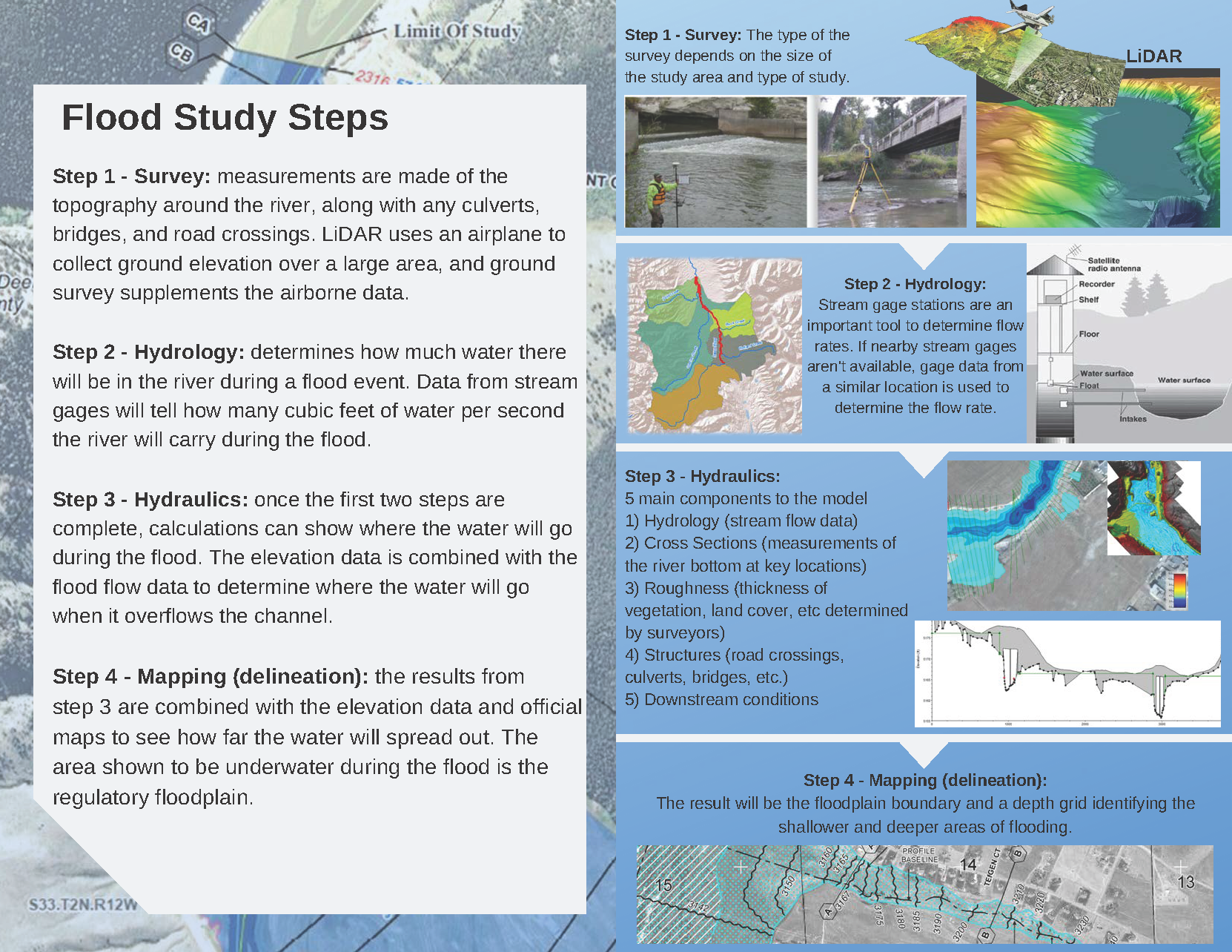
Reports are available from the local Floodplain Administrator upon request.
Contact Information
For more information on the project please contact the local floodplain administrators.
Powell County
Amanda Cooley
acooley@powellcountymt.gov
(406)846-9711
City of Deer Lodge
James Jess
jjess@cityofdeerlodgemt.gov
(406)846-3925