The Upper Missouri River Basin is one of the four Montana regional water resource planning basins, covering an area from the headwaters in the Centennial Mountains of southwest Montana downstream to the confluence with the Marias River at the town of Loma. Available below is the 2014 Upper Missouri River Basin Water Plan as well as other technical reports that address a variety of water resource issues related to the Upper Missouri River Basin.
For more information regarding watershed planning in the Upper Missouri RIver Basin please contact Danika Holmes at (406) 444-1451.
For more information regarding watershed planning in the Upper Missouri RIver Basin please contact Danika Holmes at (406) 444-1451.
 Click to Expand
Upper Missouri Basin Information
Upper Missouri River Basin Water Plan - 2014 View the Report
- Appendix A - Instream Flow rights by Sub-basin
- Appendix B-E - Water Reservations Granted to the Bureau of Land Management, Water Reservations Granted to the Dept. Of Environmental Quality, Summary of Upper Missouri Conservation District Water Reservations and Summary of Municipal Water Reservations
- Appendix F - Socioeconomic Portrait of the Upper Missouri
- Appendix G - Methods for Estimating Water Use
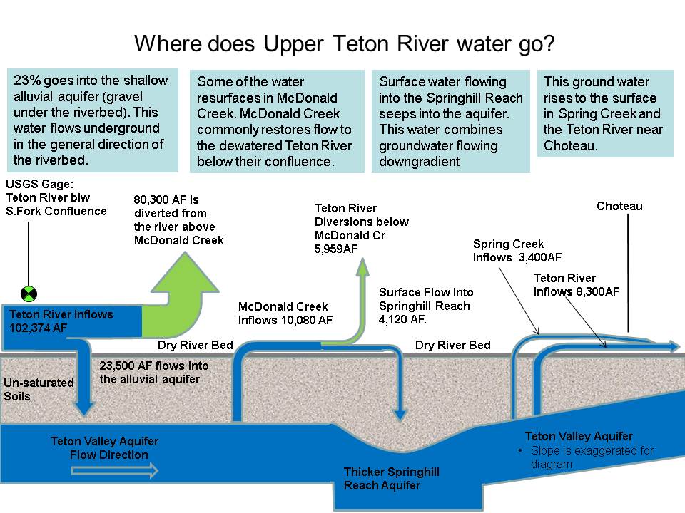
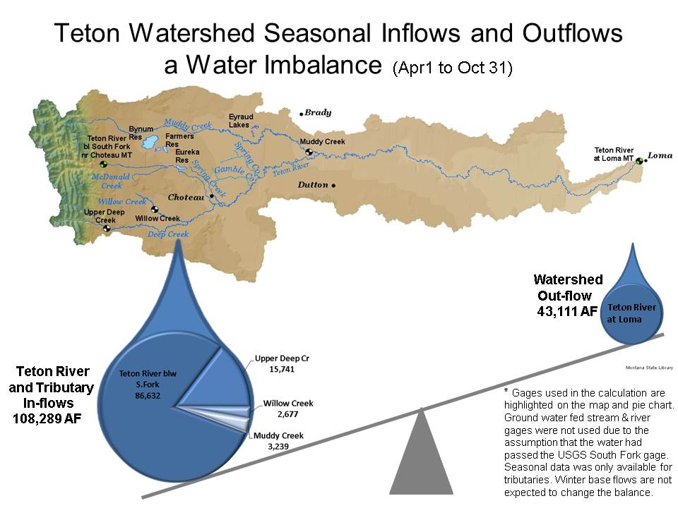
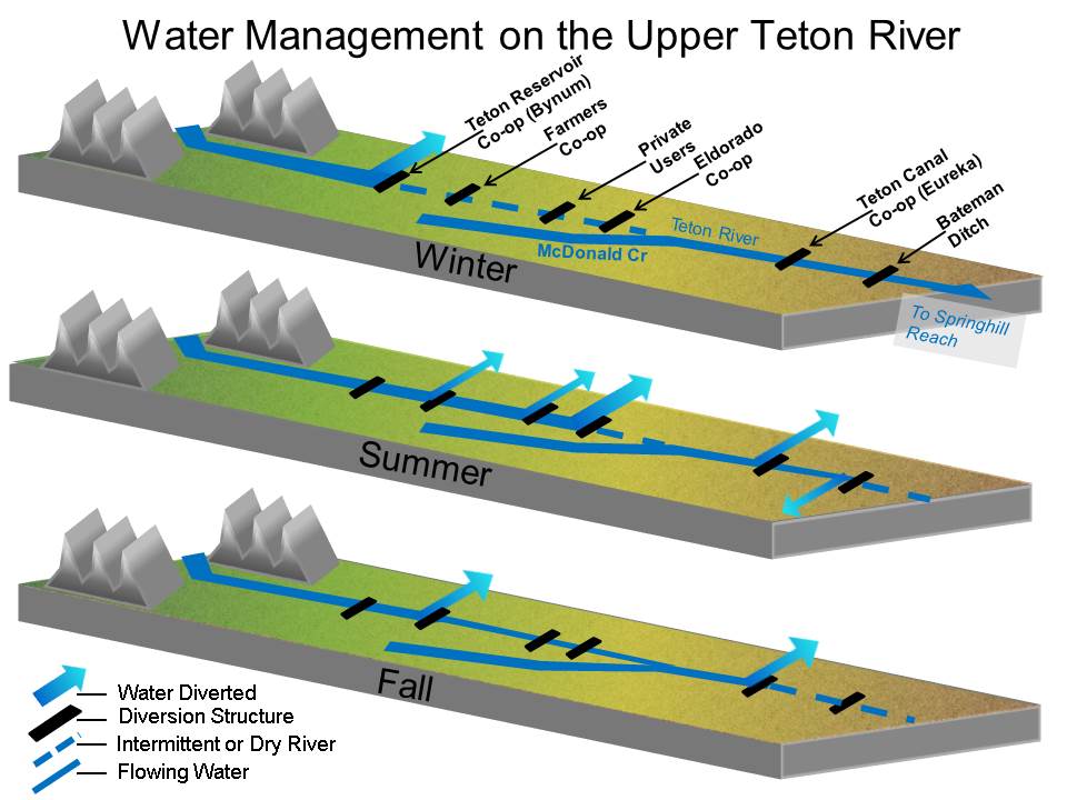
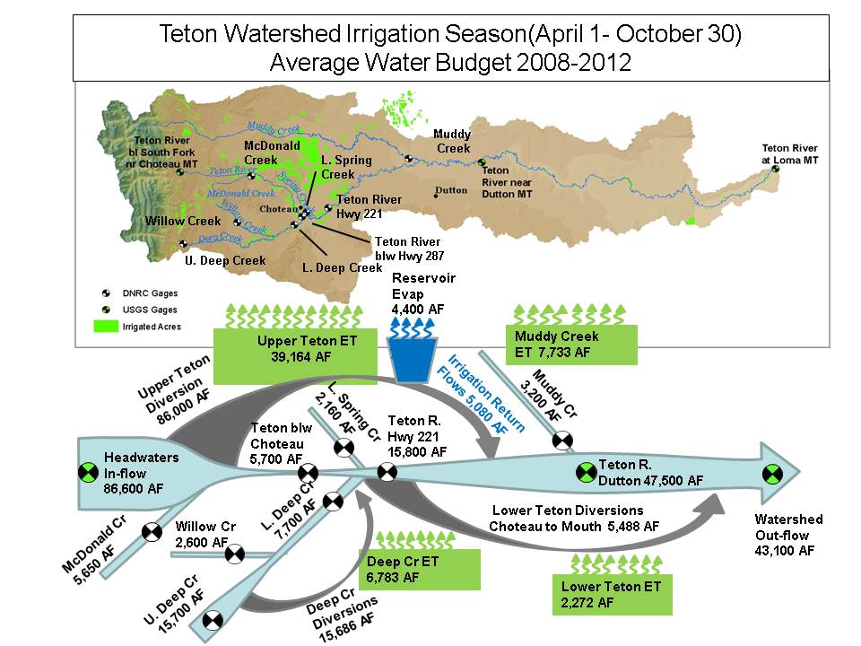
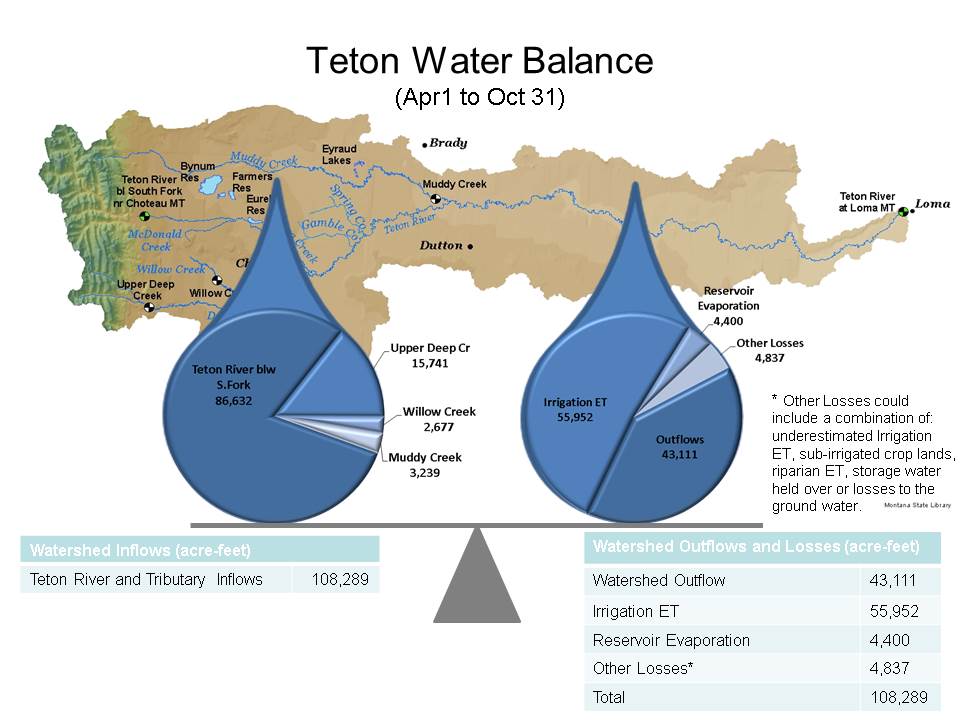
Teton Watershed Study
The Teton Watershed study characterizes the surface water hydrology and to a lesser extent the hydrogeology of the Teton River watershed. The goal of the study is to improve the understanding of the water supply and demands in the watershed as well as the effects of dewatering the river.
Contact Todd Blythe for additional information.