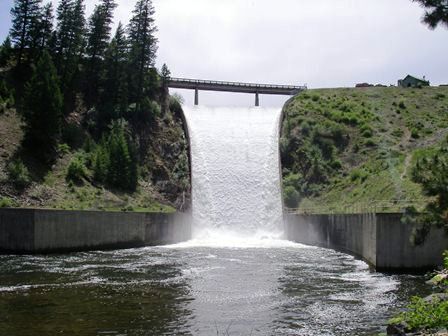
Reservoir Operations
The operation of Painted Rocks Reservoir involves three main parties: DNRC, the Painted Rocks Water Users Association (PRWUA), and the Montana Fish, Wildlife, and Parks (FWP). Painted Rocks Reservoir stores approximately 32,362 acre-ft (ac-ft) of water, with 25,000 ac-ft mark feted to the FWP and PRWUA. In addition, the Bitterroot River Water Commissioner manages the river to ensure the apportionment and diversion of decree and contract waters.
DNRC owns the dam and the reservoir area. It is DNRC’s responsibility to ensure that the reservoir is filled and operated safely and that water is available for delivery to the contract holders when it is called for.
The shares marketed to the PRWUA (10,000 ac-ft or 2/5th) is primarily used for agricultural purposes. This water can only be released when called for by the PRWUA. If you have any questions regarding the releases of contract irrigation water, please contact the PRWUA.
The shares marketed to FWP (15,000 ac-ft or 3/5ths) are used for in-stream flows. This water is released when called for by the FWP. If you have questions regarding the releases of contract fisheries water, please contact the FWP. The local FWP contact in the Bitterroot Valley is Chris Clancy (406-363-7169).
|
Date Last Updated: |
3/22/2024 |
|
Reservoir Elevation (FT_MSL) |
4,747.7 |
|
Current Storage (ac-ft) |
10,865 |
Inflows to Painted Rocks
|
Stream Name |
|
Flow Rate (cfs) |
|
Blue Joint Creek |
|
-- |
|
West Fork Bitterroot River |
|
-- |
|
Overwich Creek |
|
-- |
|
Slate Stage |
|
-- |
|
Little Boulder Creek |
|
-- |
|
Total Inflow |
|
-- cfs |
Outflows from Painted Rocks Reservoir
|
USGS Gauge (ft) |
-- |
|
Outflow before gate adjustment (cfs) |
-- |
|
Outflow after gate adjustment (cfs) |
-- |
Water Contracts
|
|
Current Flow |
Previous Flow Rate |
Volume Delivered to Date |
Volume Remaining |
Days Remaining at Current Flow |
|
Irrigation Contracts (10,000 |
-- |
-- |
-- |
-- |
-- |
|
In-Stream Fisheries Contracts (15,000 |
-- |
-- |
-- |
-- |
-- |
|
Comments |
West Fork of Bitterroot Abv Painted Rocks Blue Joint Creek above Painted Rocks Reservoir
At this time I want to remind everyone how Painted Rocks Reservoir is managed, who the primary stakeholders are, and how water releases are determined.
If you are interested, here are the online gages for Blue Joint Creek Painted Rocks Dam outflow information |
||||
