In 1993, a water rights compact with the National Park Service for the Yellowstone and Glacier national parks and Big Hole National Battlefield was passed by the Montana Legislature. The 1995 Montana Legislature ratified a compact for the remaining two Park Service units, Little Bighorn Battlefield National Monument and Bighorn Canyon National Recreation Area, completing Park Service negotiations in Montana. The two compacts were consolidated by the Montana Legislature into a single compact that provides water for instream flow, park facilities and residences, irrigation, and a separate right to water for emergency fire suppression. The compact also provides for water rights to preserve the resources and hydrothermal features in Yellowstone National Park. The Montana Water Court issued a final decree for this compact in April 2005 (Case # WC-94-1) and issued its Certification and Final Judgment in April 2016.
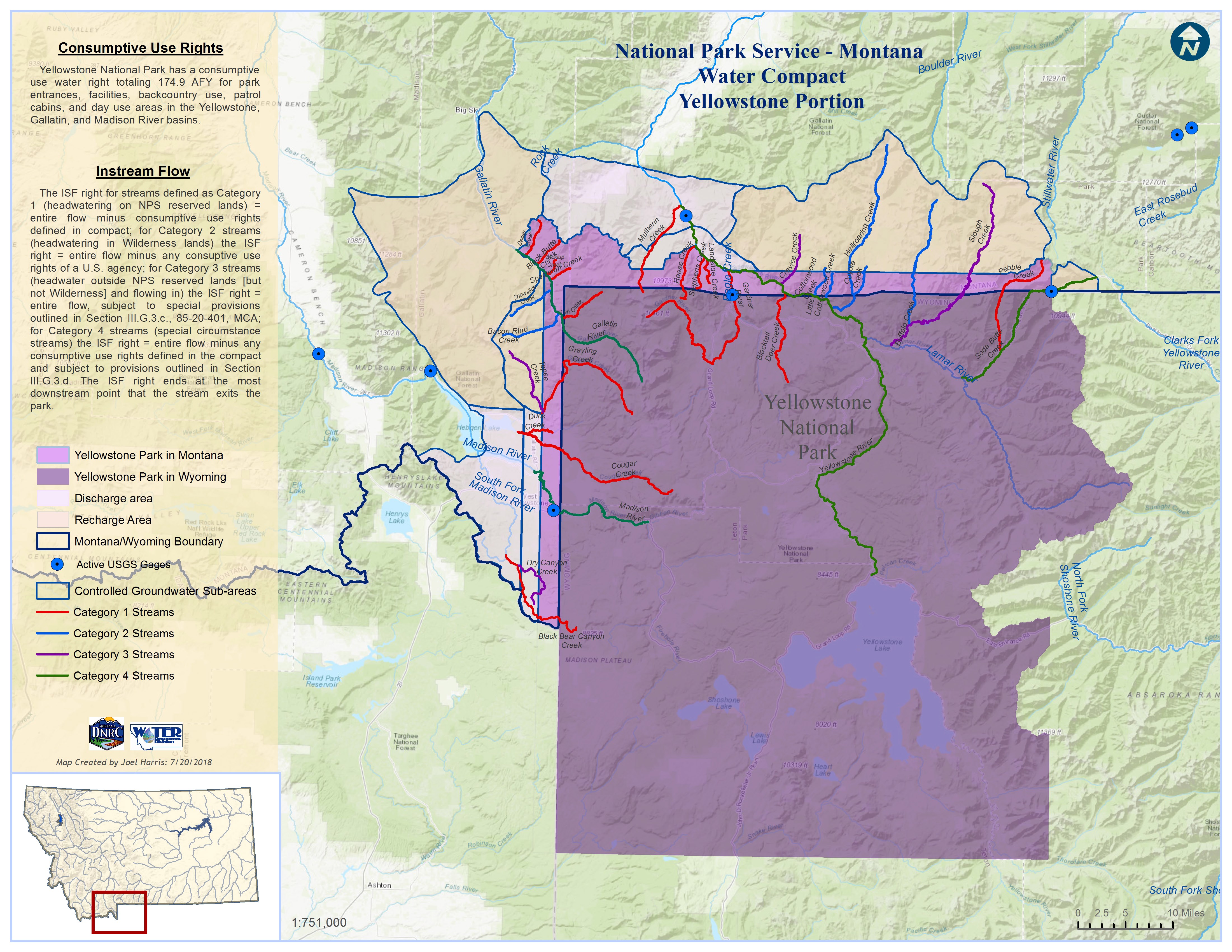
Yellowstone National Park:
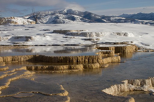
The Compact quantifies the following reserved water rights in the Yellowstone, Gallatin, and Madison basins for the portion of Yellowstone within the State of Montana:
- Consumptive use rights for entrance facilities, patrol cabins, day use areas, backcountry use, and other facilities.
- Instream Flow rights for sources of water originating on and flowing through or adjacent to the park.
- Lake level rights to maintain natural lake levels within the park.
- Hydrothermal water rights for Hot Springs trubtary to Bear Creek
- The Compact also establishes the Yellowstone Controlled Groundwater Area (see Yellowstone Compact Map below for boundary) which is an area north of the park boundary with a special permitting process for state law-based water rights intended to protect the special hydrothermal resources of the Park in perpetuity. See the following document link for more information about the permitting process within the controlled groundwater area: Yellowstone Controlled Groundware Area Permit Process
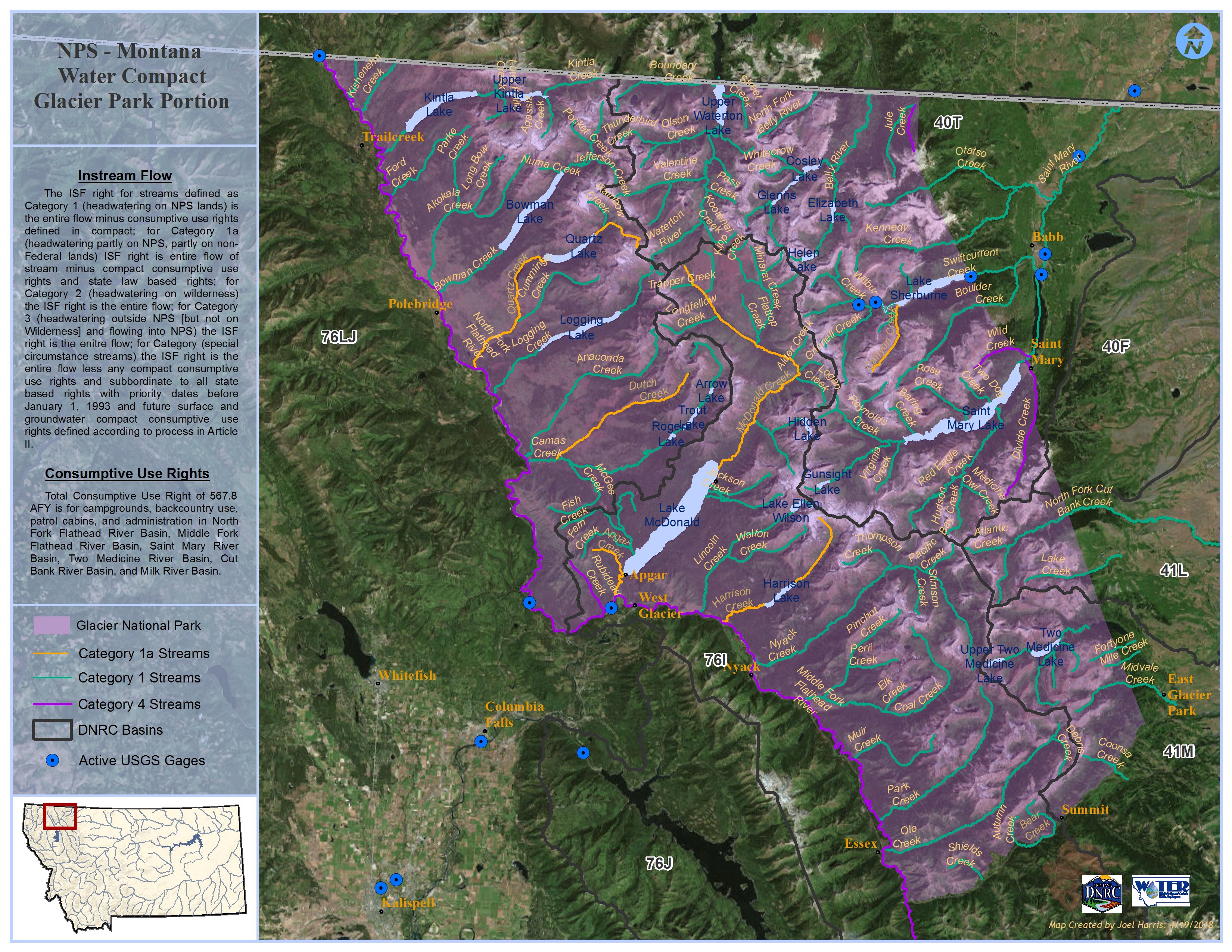
Glacier National Park:

The Compact quantifies the following reserved water rights in the Saint Mary, Two Medicine, Cut Bank, Milk, and North and Middle Fork Flathead River basins for Glacier National Park:
- Consumptive use rights, including future uses, for campgrounds, patrol cabins, general area use, stations, backcountry use, and other facilities.
- Instream Flow rights for streams within or bordering the park.
- Lake Level rights for the maintenance of natural water levels within the park.
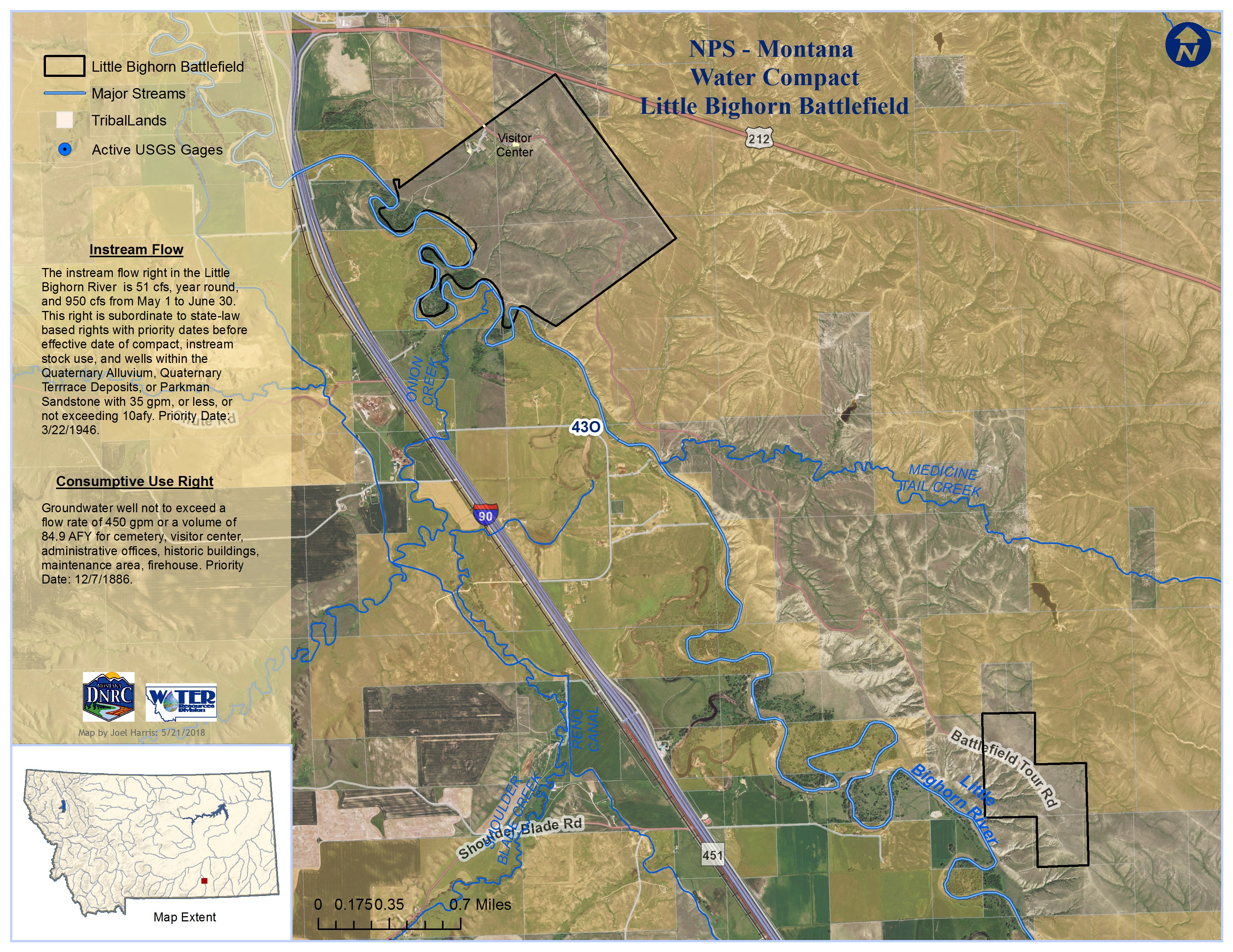
Little Bighorn Battlefield National Monument:
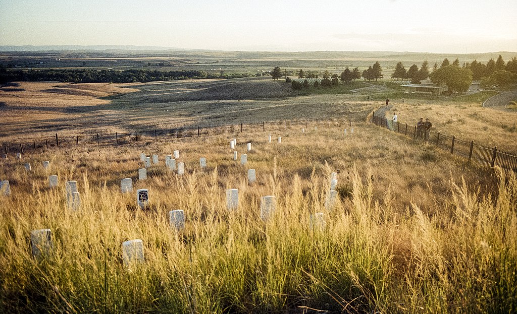
The Compact quantifies the following reserved water rights in the Little Bighorn River basin:
- Consumptive Use rights for administrative offices, residences, historic buildings, firehouse facilities, a maintenance area, cemetery, and other administrative uses.
- Instream Flow right on the Little Bighorn River (51 cfs) where it forms the boundary of the national monument, subordinate to any water rights existing before the effective date of the compact (May 30, 1995)
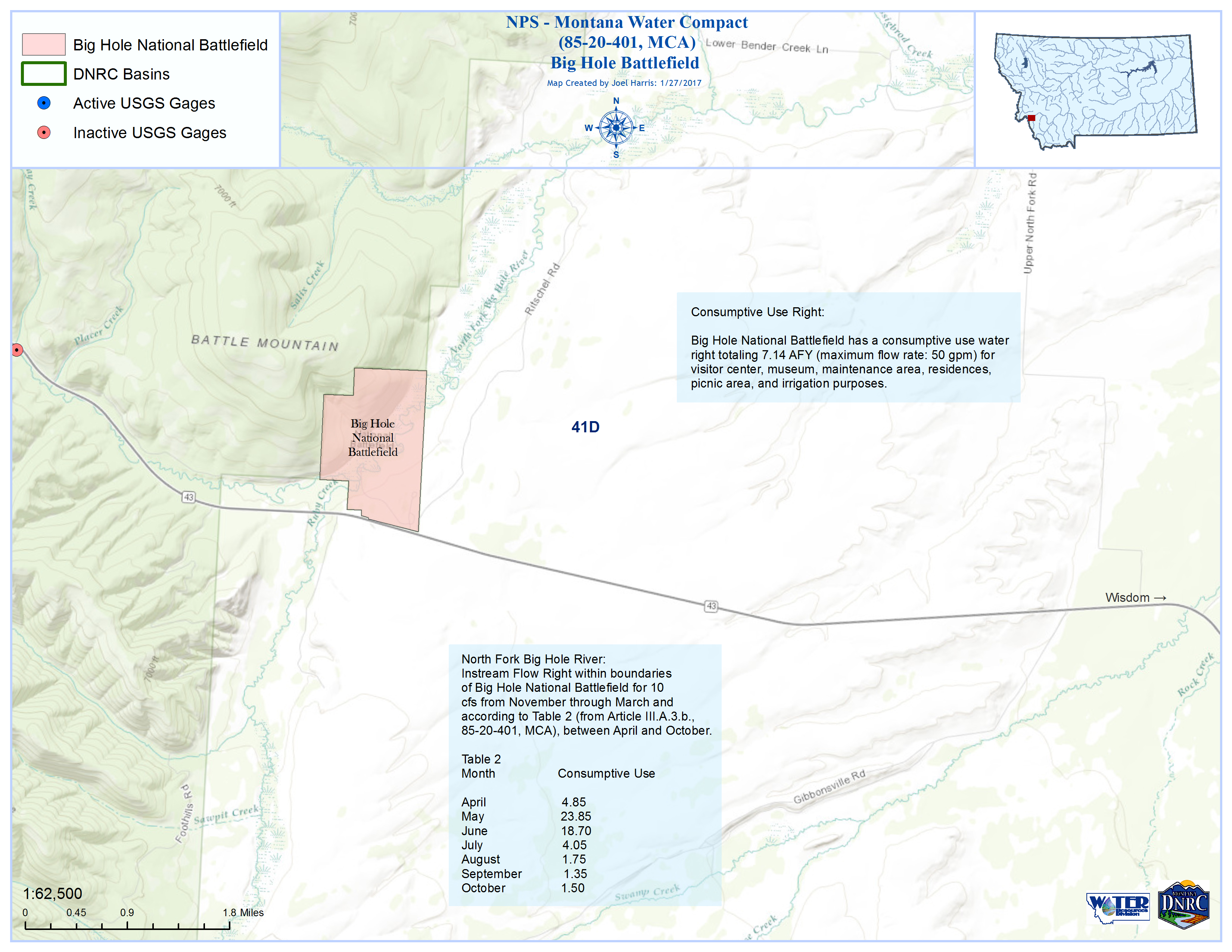
Big Hole National Battlefield:
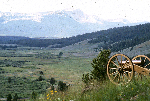
The Compact quantifies the following reserved water rights in the Big Hole River basin:
- Consumptive Uses, including future use volumes up to the amounts in table 2 of the compact, for visitor center, museum, maintenance area, residences, picnic grounds, and irrigation.
- Instream Flow right in the North Fork of the Big Hole River of 10 cfs from November through March and for the entire flow between April and October (minus future consumptive uses shown in Table 2 of the compact and state water rights in existence before the effective date (January 31, 1994))
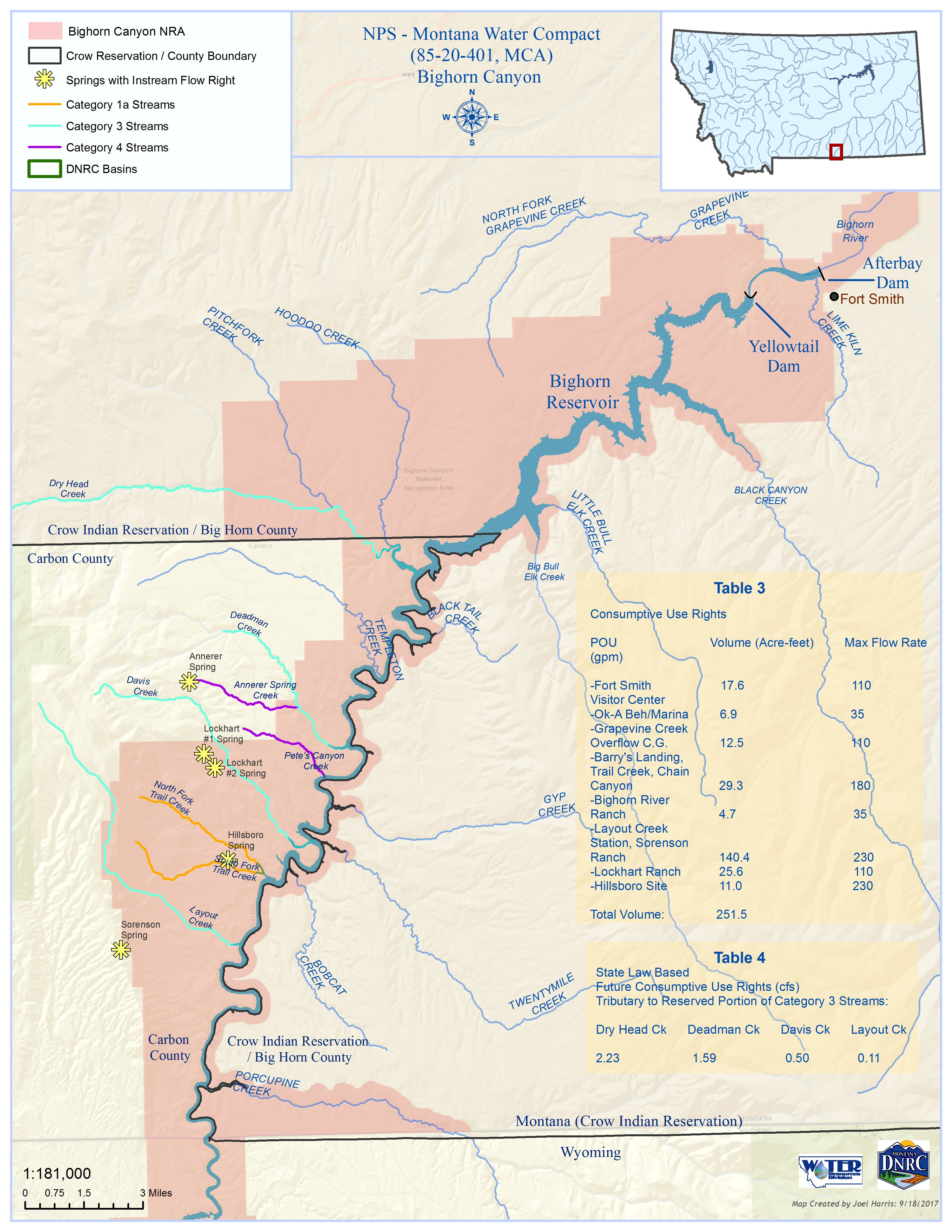
Bighorn Canyon National Recreation Area:
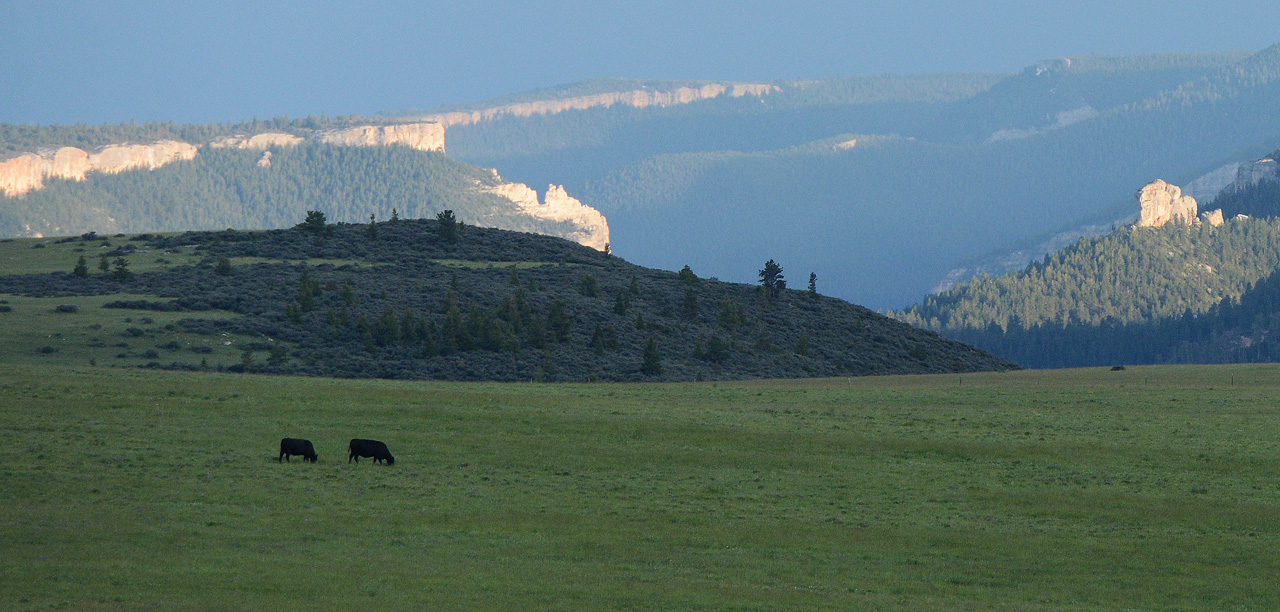
The Compact quantifies reserved rights in the Bighorn River basin for:
- Consumptive uses, including future uses on category 3 streams, within the National Recreation Area for a visitor center, a marina, campgrounds, boat launch areas, a ranger station, ranches, stock and wildlife watering sites, and other administrative uses.
- Instream Flow for streams flowing through the Recreaction Area.
- Springs within the recreation area, namely Sorenson, Lockhart #1, Lockhart #2, and Hillsboro Springs.