Richland County has been working with the Federal Emergency Management Agency (FEMA) and Montana Department of Natural Resources and Conservation (DNRC) to produce new and updated 1% annual chance (100-year) floodplain maps. The project includes updating all the existing mapped floodplains for the Missouri River and Tributaries and the Yellowstone River Tributaries. The Yellowstone River maps were updated a few years ago.
Updated floodplain maps will depict the latest, most accurate flood risk data, and will eventually result in updated FEMA floodplain maps. Most of the existing maps for these streams are based on older data. These maps need to be updated periodically. For more information see: Floodplain FAQs Flood Study Process
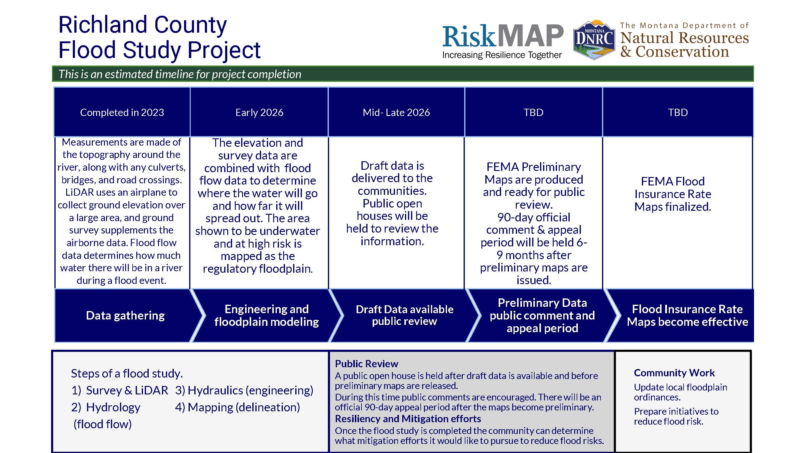
Project Timeline
Flood Insurance Rate Maps indicate areas of flood risk. Once this project is complete, new and updated Flood Insurance Rate Maps will provide more accurate, current, and detailed data and mapping of flood risk areas. New floodplain studies involve collecting and analyzing data, including: topography, hydrology analyses and hydraulic analysis.
Project Updates
Data development is currently underway, check back for project updates and the availability of draft data when data development is complete.
Project kick off meeting
September 21, 2022 | Richland County | view handout
State Flood Hazard Viewer
Draft data is not yet complete for the project area. Once the data is complete it will be loaded onto the State Flood Hazard Viewer to share with the public.
Contact Information
For more information on the project please contact the local floodplain administrator.
Richland County
Josh Johnson
joshua.johnson@richland.org
(406) 433-2407
City of Sidney
Jeff Hintz
sidneydpw@midrivers.com
(406) 433-2809